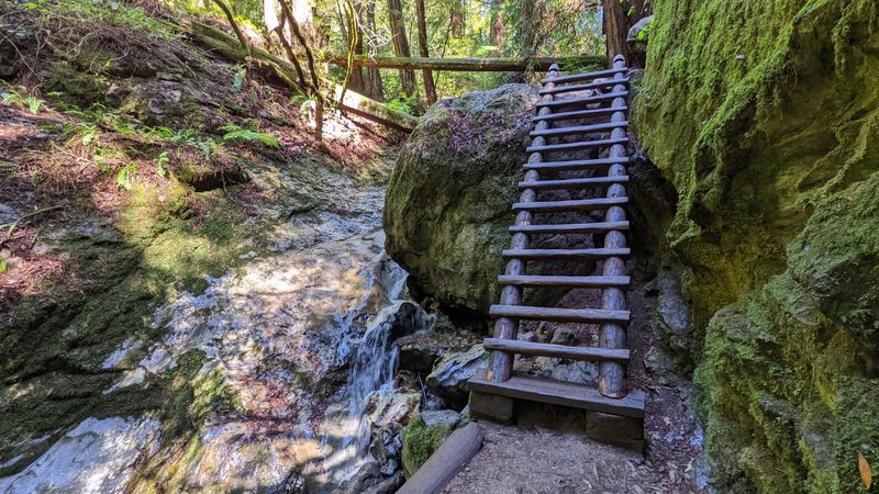
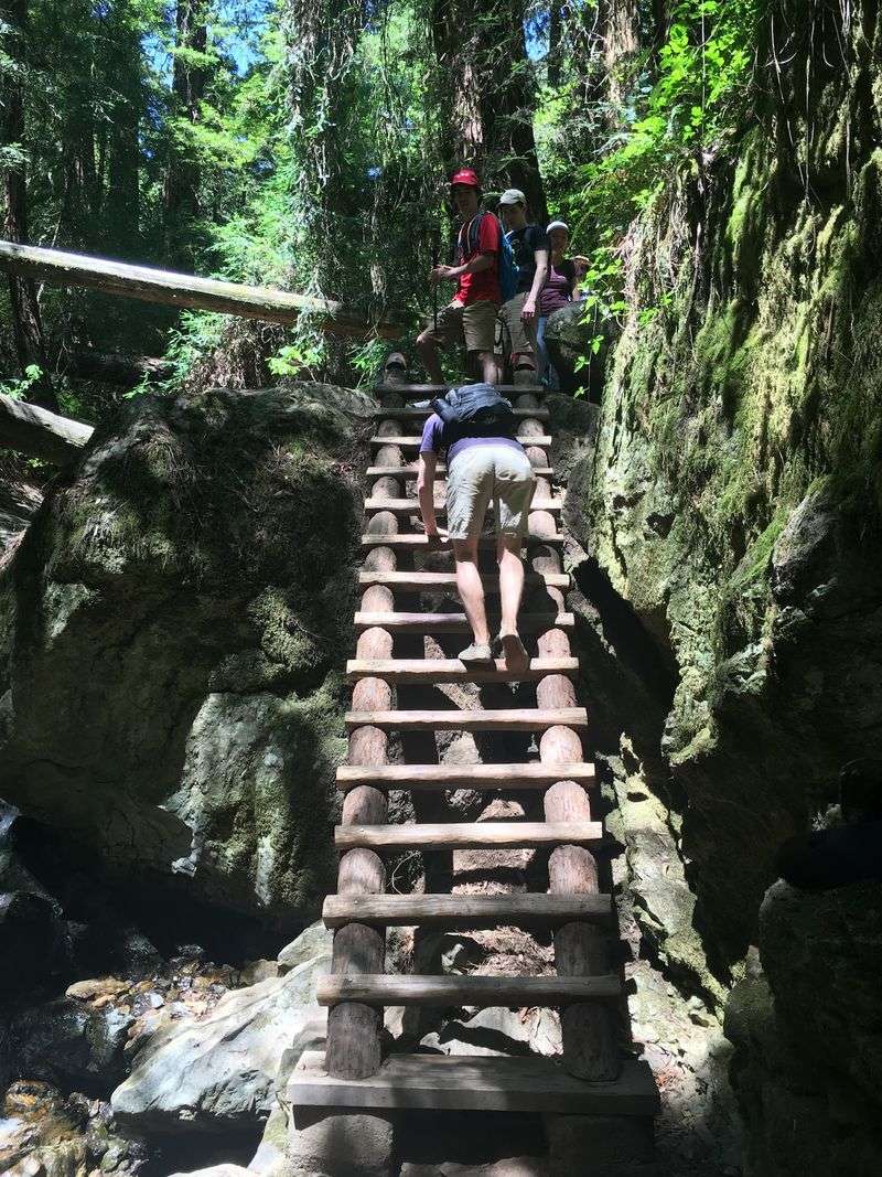
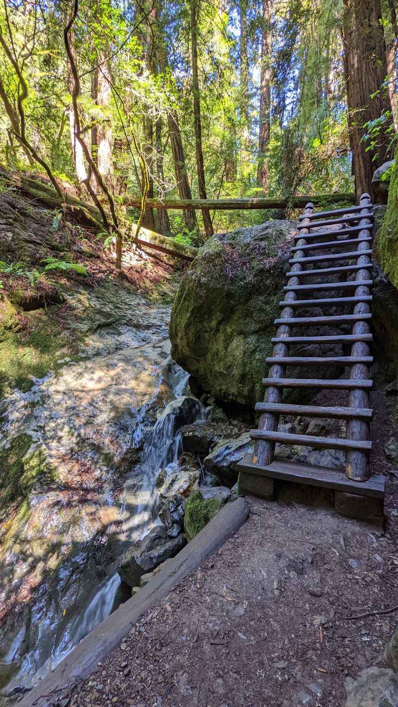
Halfway down this canyon trail, the path simply stops at a 14-step redwood ladder. There’s no detour and no bypass.
If you want to finish the loop, you climb.
That ladder sits over a creek that flows all year. Around it, redwoods crowd the canyon walls, and ferns and moss cling to the rocks.
Wooden bridges hop back and forth across the water.
I like how November changes the mood here. The rainy season starts waking up the waterfalls and turning the moss bright green.
It feels like the canyon is finally clearing its throat after a dry summer.
The whole loop runs just under four miles, all within an easy drive of San Francisco, California. It also ends with ocean views.
So how many hikes let you trade a forest ladder for the Pacific in one afternoon?
A Redwood Canyon Trail Just North Of San Francisco
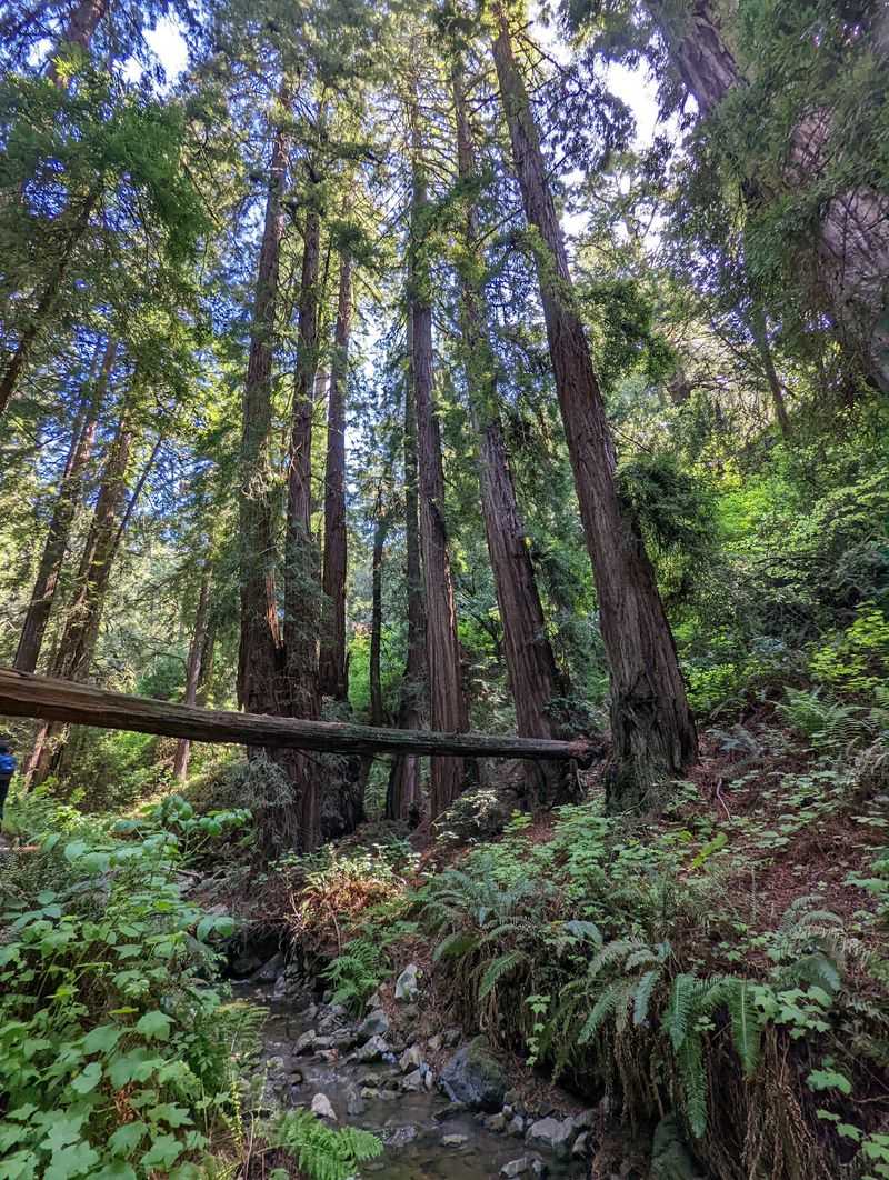
About 40 minutes from San Francisco, a trail drops off the shoulder of a mountain and disappears into redwoods. That’s the Steep Ravine Trail, and it lives inside Mount Tamalpais State Park in Marin County.
The trail follows Webb Creek down a tight, shaded canyon toward the coast near Stinson Beach. Along the way, it packs in waterfalls, wooden bridges, carved stone stairs, and one famous ladder.
On its own, the Steep Ravine Trail covers about 1.7 miles from the top. Most hikers fold it into a loop with the Dipsea and Old Mine trails.
That combo stretches just under 4 miles and usually takes about two hours.
Two hours sounds modest, and honestly, that’s part of the appeal. You don’t need a full day or a backpacking permit to feel far from the city.
You just need decent shoes and a willingness to climb a ladder.
The canyon is heavily trafficked, which makes sense once you see it. Few places in California squeeze this much scenery into such a short walk.
It’s the kind of trail Bay Area hikers recommend to friends, then quietly hope stays uncrowded.
Nearly Ninety Years Of Footsteps In One Canyon
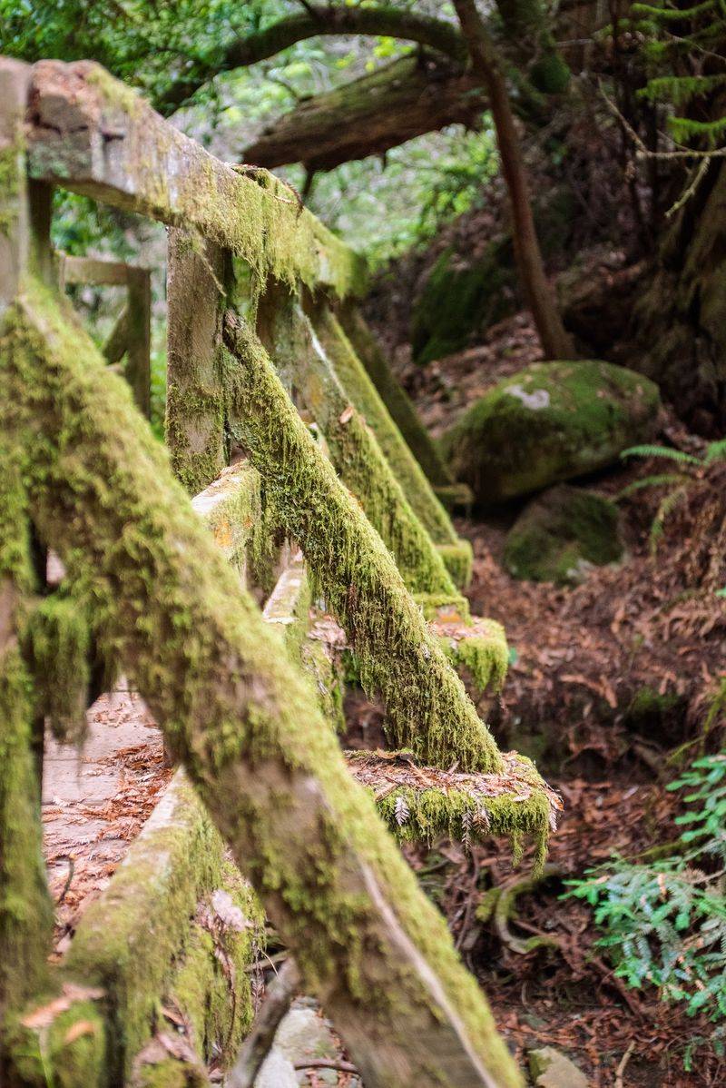
Long before trail apps and step counters, people were already hiking this ravine. The Steep Ravine Trail has existed since the mid-1930s.
That makes it older than many of the highways people use to reach it.
Its age shows in the best way. Stairs are carved right into the canyon walls in places.
The route feels built by hand and kept alive by care rather than bulldozers.
The ladder carries its own small mystery. Early written sources don’t pin down exactly when the first one appeared.
Historical photos suggest a ladder has stood here for a very long time, though.
Today, California State Parks crews maintain the redwood ladder and rebuild it when needed. So the version you climb is part of a long line of replacements.
It’s a little like a family heirloom that keeps getting refreshed.
In fast-changing California, a trail with nearly a century behind it feels like a small act of preservation. Generations of Bay Area families have climbed these same rungs.
When you grip that rail, you’re joining a very old, very local tradition.
Fourteen Redwood Rungs With No Way Around
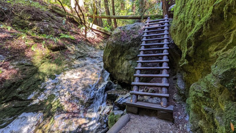
Fourteen steps. That’s all it is, yet this ladder gets more attention than most summit views.
It’s made of redwood and fixed in place over Webb Creek and a jumble of rock.
Here’s what surprises first-timers. There’s no bypass trail around it.
If you’re doing the loop, the ladder is simply part of the deal.
Don’t let that scare you off. It’s short, sturdy, and well-maintained by state park crews.
Most hikers treat it as the fun moment of the day rather than an obstacle.
A few tips make it smoother. Keep your hands free by stashing water bottles and phones in a pack.
Take your time on wet rungs, since the canyon stays damp, especially after rain.
One piece of advice comes up again and again. Avoid climbing down the ladder backward.
Face it the right way and move steadily, and you’ll be fine.
Kids usually love this part, and plenty of adults secretly do too. It turns a pretty forest walk into a tiny adventure.
Good luck resisting a photo at the top.
Why November Is When The Waterfalls Wake Up
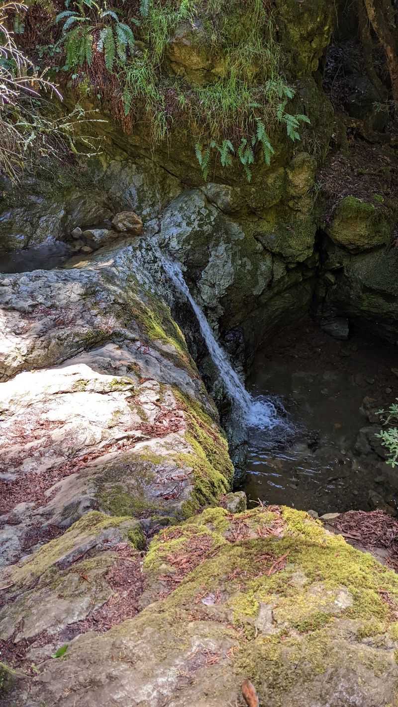
Webb Creek runs all year, which already sets this canyon apart from many California streams. The real show, though, starts when the rain returns.
Late fall marks the start of the rainy season in Marin. As storms roll in, the creek can pick up volume.
The cascades along the trail often get much more exciting through winter and spring.
That timing is why November is such a sweet spot. The canyon begins shifting from its dry-season hush to something louder and greener.
You catch the transition while it’s happening.
Rain also brings the moss back to life. Rocks and branches can go from dull to glowing green after a few good storms.
Ferns perk up along the banks too.
Of course, nature keeps its own calendar. Early-season flows depend on how much rain has actually fallen.
A wet week can make a huge difference, so check the forecast and recent rainfall before heading out.
Still, even a modest creek sounds lovely echoing off canyon walls. And if the falls are only warming up, you’ve got a great excuse to return in January.
Bridges, Ferns, And Stairs Carved Into Stone
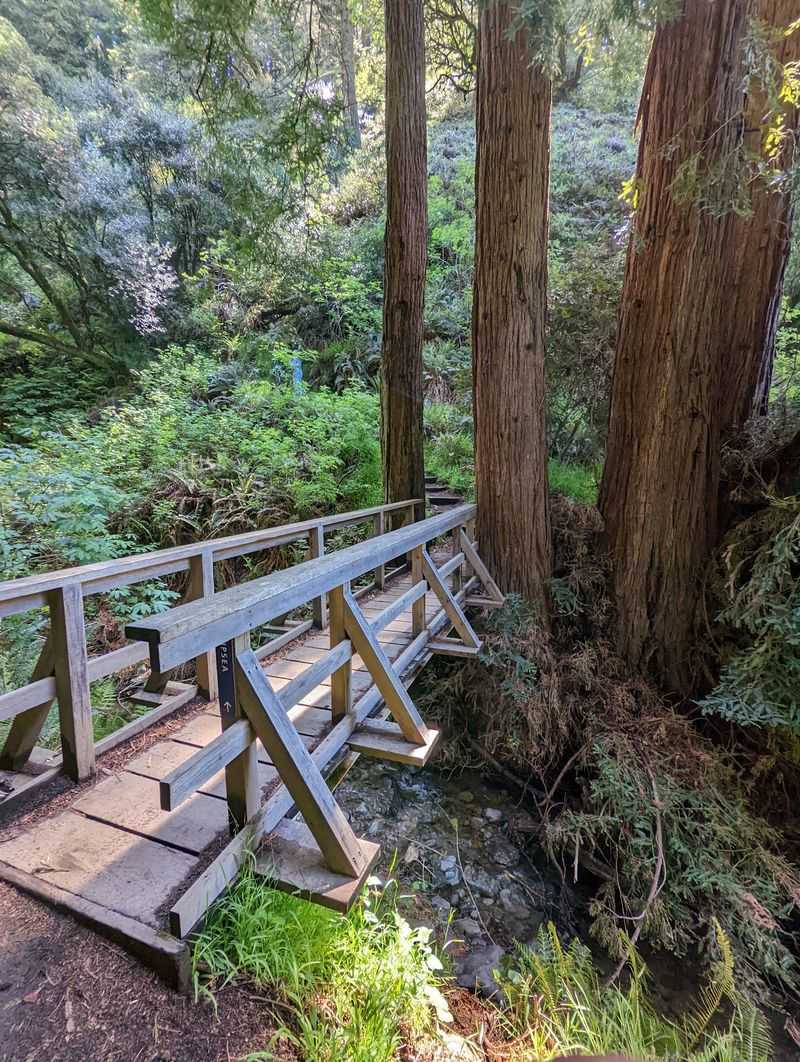
Count the bridges as you go, and you’ll lose track fast. Wooden footbridges carry the trail back and forth across Webb Creek.
Each crossing gives you a fresh angle on the water below.
Between those crossings, the path keeps changing texture. Sections of stairs are carved straight out of the canyon walls.
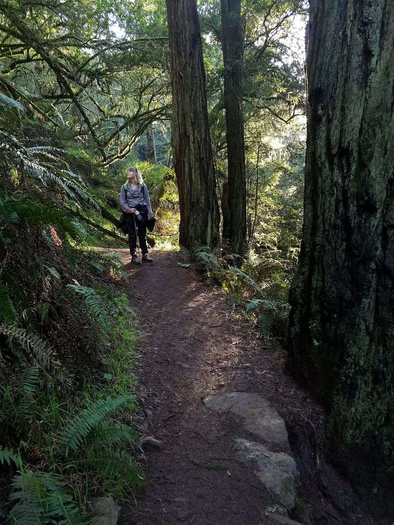
Other stretches wind under redwoods past thick ferns and moss-covered rocks.
It’s a busy trail in the best sense. Your eyes always have something new to land on.
A bridge, a cascade, a twisted root, then another bridge.
The redwood canopy also keeps things cool and shaded. That shelter helps on drizzly days, since the trees can block some of the rain.
It’s one of the rare hikes where gray weather feels like a bonus.
All that greenery comes with one catch. The trail can turn slippery when it’s wet, especially on stone steps and roots.
Shoes with good traction aren’t optional here.
Slow down anyway. This canyon rewards people who stop on a bridge and just listen to the creek for a minute.
Trading Redwood Shade For Pacific Views On The Dipsea
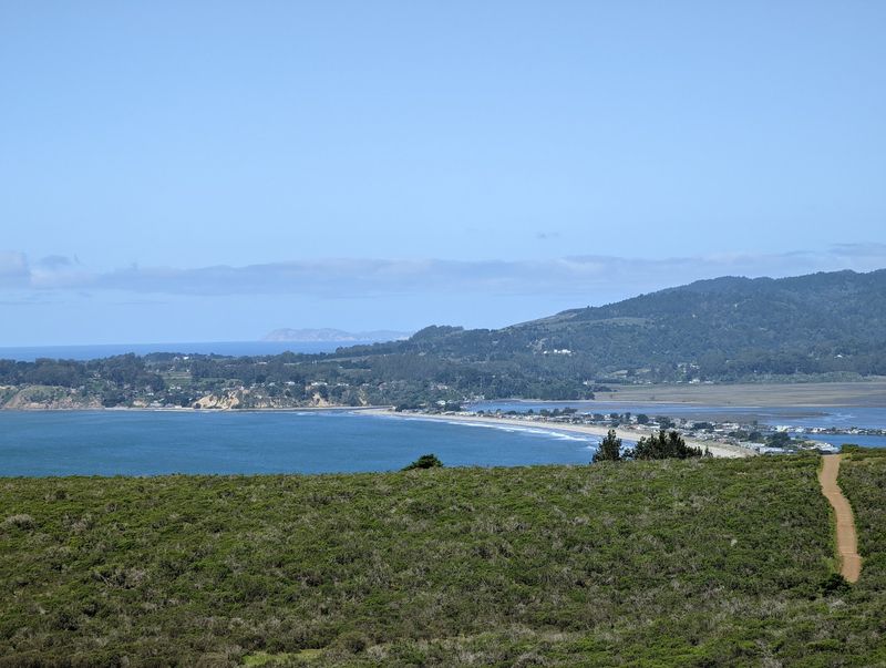
After the canyon, the loop pulls off one of the best scene changes in the Bay Area. You leave the shady redwoods and step onto the Dipsea Trail.
The standard route from Pantoll goes like this. Descend the Steep Ravine Trail for about 1.7 miles.
Then turn left onto the Dipsea Trail for roughly 1.6 miles.
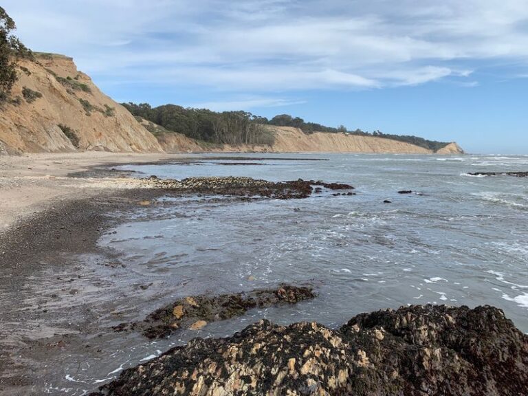
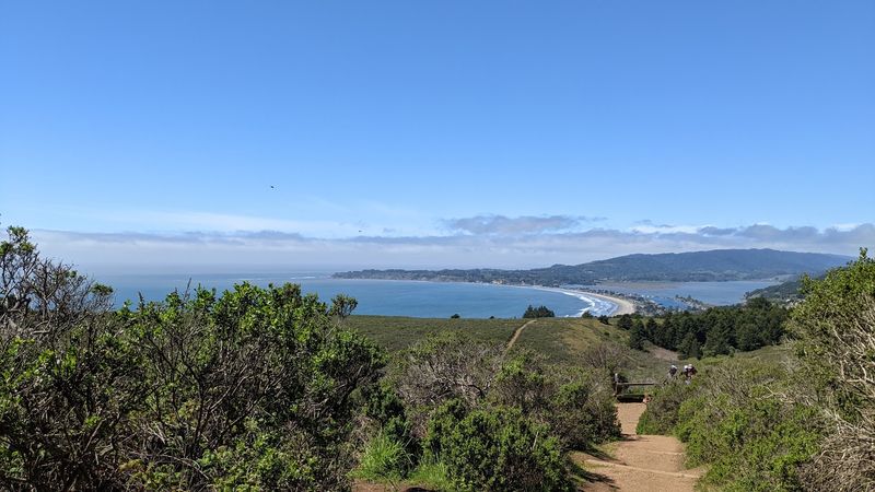
Parts of the Dipsea open up to rolling hills and views of the Pacific Ocean. After an hour inside a damp green canyon, that sudden sky feels enormous.
The name might ring a bell for running fans. The Dipsea is a well-known Marin trail, and walking a piece of it feels like a nice bonus.
You get bragging rights without any race bib.
From the Dipsea, you’ll turn left onto the Coastal Fire Road. A quick right puts you on the Old Mine Trail, which leads back toward the parking lot.
The full loop lands around 3.9 miles.
That contrast is what makes the hike memorable. Forest, ladder, waterfalls, then ocean, all before lunch.
Not a bad morning in California.
Who Will Love This Loop Most
Short attention spans, meet your match. With a ladder, creek crossings, and waterfalls all packed into two hours, the Steep Ravine loop keeps curious kids busy.
That said, the name isn’t a joke. The canyon is steep, and the loop involves real elevation change between Pantoll and the Dipsea.
Climbing back up means steady effort for small legs.
Families with older kids who’ve done a few hikes tend to be a great fit. So do adults who want big scenery without committing a whole weekend.
Photographers will find plenty to frame too.
Nature lovers who enjoy moss, ferns, and moving water will be especially happy here. The canyon has a calm, enclosed feel.
It’s a nice reset from screens and traffic.
One group needs a different plan. Dogs aren’t allowed on the Steep Ravine and Dipsea Trail loop.
Leave your four-legged hiking buddy home for this one.
Anyone uneasy about ladders should know there’s no way around it on the loop. The good news is it’s only 14 steps.
Most people are surprised how quickly it’s over.
Parking Strategy Matters More Than Your Playlist
Most Steep Ravine adventures begin with a small parking puzzle. The most common starting point is the Pantoll Campground lot, also called Pantoll Ranger Station, off Panoramic Highway.
There’s a parking fee at Pantoll, so bring a payment method. Spaces are limited, and the trail is heavily trafficked.
Arriving early, especially on weekends, can save a lot of circling.
If Pantoll fills up, limited parking also exists near Bootjack Campground. It’s worth knowing as a backup before you start the drive.
There’s a third option for those who prefer a different shape of hike. A small lot sits at the bottom of Steep Ravine off Highway 1, near Stinson Beach.
Starting low means you climb first and descend later.
For mapping, the trail sits near coordinates 37.8950752, -122.6152123 in California. Plugging in Pantoll Ranger Station is usually the simplest route.
Panoramic Highway curves plenty, so budget extra time. Weekday mornings in November can be a smart call for quieter trails.
Fewer cars, more creek sounds, and maybe the ladder all to yourself.
What To Pack For A Damp Canyon Day
Footwear tops the list, no contest. Wet stone stairs, roots, and ladder rungs all reward shoes with solid traction.
Slick-soled sneakers are asking for trouble.
A light rain jacket makes sense in November too. The redwood canopy helps with drizzle, but the coastal stretch on the Dipsea is more exposed.
Layers let you adjust as you move between shade and sun.
Pack with the ladder in mind. A small backpack keeps both hands free for climbing.
Juggling a water bottle on rung nine isn’t anyone’s idea of fun.
Bring water and a snack for the climb back toward Pantoll. Even on a cool day, the uphill sections can warm you up quickly.
A mini break on a bridge never hurts either.
Your phone or camera will get a workout. Waterfalls, ferns, and ocean views all compete for attention.
Just keep it zipped away while you’re on the ladder.
Finally, check recent weather before leaving. Fresh rain can boost the waterfalls but also make the trail muddier.
Plan for both, and you’ll enjoy every soggy, gorgeous minute.
A Short California Hike That Earns Its Reputation
Plenty of trails promise variety. Few actually deliver forest, waterfalls, a ladder, and ocean views in under four miles.
The Steep Ravine Trail pulls it off with surprising ease. Its loop with the Dipsea and Old Mine trails fits neatly into a morning.
Yet it feels like you’ve wandered much farther from the city.
Timing makes November especially appealing. The rains begin returning, the moss starts glowing, and Webb Creek can find its voice again.
Catching that seasonal shift feels like being let in on a secret.
The history adds quiet weight too. People have walked this canyon since the mid-1930s.
State park crews keep the redwood ladder standing for the next wave of climbers.
It isn’t a hike for dogs, and it isn’t a stroller trail. It’s steep, damp, and sometimes busy.
Those quirks are part of its character.
For anyone in California craving a day trip with real personality, this canyon is hard to beat. Grab good shoes, leave early, and go hear those waterfalls.
Fourteen rungs are waiting.