One of the most famous views in California hangs 3,200 feet above a valley floor, and a paved path leads you right to it. No ropes, no blisters, no fancy gear, just a parking lot and a short stroll.
That surprised me. I always assumed big views came with a price, like hours of switchbacks and a sunburn on the back of my neck.
Apparently not.
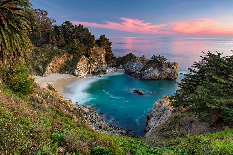
It turns out the state hands out jaw-droppers to anyone willing to walk for about five minutes in regular shoes. One waterfall even pours onto a beach, and you reach its overlook through a tunnel under a highway.
Another spot lets you stare down at the San Andreas Fault from roughly a mile up. Honestly, I love that kind of lazy payoff, and I suspect you will too.
Grab your sunglasses. Which view would you chase first?
1. Battery Spencer, Sausalito, CA
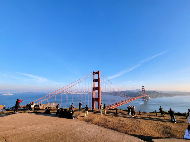
Five minutes on foot is all that stands between the Conzelman Road parking area and a postcard view. Battery Spencer sits high on the Marin Headlands cliffs, right at the mouth of the bay.
The site itself is a 19th-century concrete battery tied to Fort Baker. Military planners picked this perch for a reason, and the reason still shows.
From the overlook, the Golden Gate Bridge fills the frame up close. Look past the towers and you can spot the San Francisco skyline and Alcatraz sitting in the water.
You don’t need special gear for the short path. Kids handle it easily, which makes it a solid stop for families visiting the Bay Area.
Timing matters here more than effort. Weekend afternoons and evenings draw the biggest crowds, while weeknights tend to be far quieter.
The overlook stays open 24 hours most days, with Monday hours running from 6 AM to 5 PM. Parking is free, both in the small lot and along the street.
The drive from the city takes under 20 minutes. For a California view this famous, that’s a pretty sweet deal.
Address: Conzelman Rd, Sausalito, CA 94965
2. McWay Falls
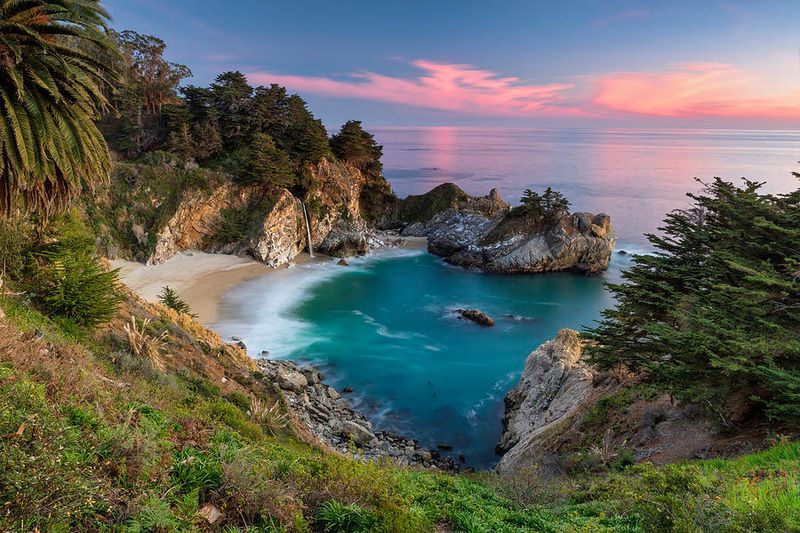
Most waterfalls make you hike to them, but this one drops 80 feet straight onto a beach. McWay Falls lands in a small ocean cove inside Julia Pfeiffer Burns State Park in Big Sur.
Getting there feels like a little adventure without the sweat. The short, easy trail passes through a tunnel under Highway 1 before opening onto the coast.
From there, a well-kept path leads to a vista point above the cove. The water below often glows aqua blue, and the falls pour right at the ocean’s edge.
You’ll look down on the scene rather than stand on the sand. That vantage point is exactly why this spot shows up in so many Big Sur photos.
Free parking is available along the road, so pull over carefully. Highway 1 can be narrow and busy in this stretch, so take your time.
The walk suits casual visitors who want a big reward for minimal effort. It also makes a smart leg-stretch on a long coastal drive between Monterey and Cambria.
Bring a zoom lens if you have one. You’ll want to capture the way the falls meet the Pacific.
Address: Highway 1, Big Sur, CA 93920
3. Zabriskie Point
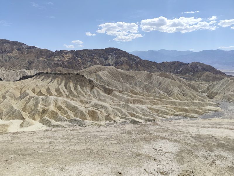
Rocks that glow gold at sunrise are the main event at Zabriskie Point. The light shifts through the day, but early morning and golden hour steal the show.
The walk is almost laughably short. A paved ramp path takes about three to four minutes and leads straight to sweeping views.
Below, the badlands roll out in ripples of color and shadow. The overlook faces the Furnace Creek area and the Amargosa Range beyond.
Low sun sharpens the shadows along the ridges. Even a phone camera can catch that contrast.
Heat is the real challenge here, not the climb. This desert national park gets famously hot, and the viewpoint has no shaded seating.
Plan around that by coming at dawn or near sunset. Busy periods include Sunday mornings and some weekday evenings, so a Friday morning may feel calmer.
Restrooms and a free parking lot make the stop easy. The viewpoint stays open 24 hours, which helps if you’re chasing first light.
Pack water and sunscreen even for this tiny stroll. California’s desert doesn’t care how short your walk is.
Address: Zabriskie Point, Furnace Creek area, California
4. Keys View
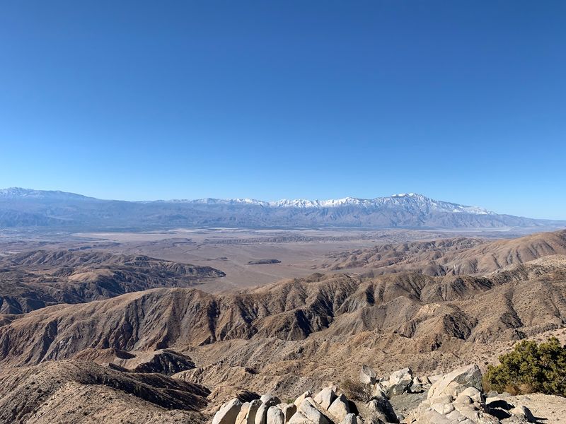
Not many overlooks let you see a famous fault line from near the parking lot. Keys View sits above 5,000 feet in the Little San Bernardino Mountains of Joshua Tree National Park.
A short paved walkway leads up to the viewpoint. It’s an easy stroll, even for anyone who’d rather save energy for the drive.
The payoff is huge. You can scan the Coachella Valley, trace the San Andreas Fault, and spot the Salton Sea in the distance.
Palm Springs and the surrounding mountains also fill the panorama. On some days, you might even see sandstorms stirring the valley floor below.
The overlook stays open 24 hours, and parking is free. Saturday evenings tend to bring the biggest crowds, while weeknights are usually quiet.
It ranks among the park’s highest spots. That elevation can mean cooler air than the desert floor, so a light jacket helps.
Pair the stop with a drive past the park’s twisted Joshua trees. Few Southern California road trips offer this much scenery for so little effort.
Address: Keys View Rd, Joshua Tree National Park, California
5. Inspiration Point (Emerald Bay)
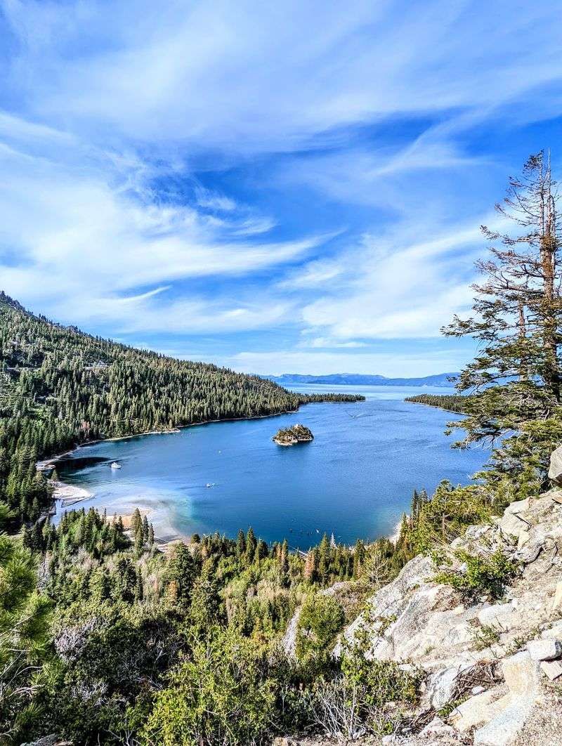
Lake Tahoe shows off its brightest colors from this roadside overlook above Emerald Bay. Turquoise water, forested granite cliffs, and tiny Fannette Island all land in one view.
You barely leave the car to see it. Paved paths and viewing platforms sit just steps from the parking area.
Mounted binoculars help you zoom in on the details. Information boards explain what you’re seeing, including a Scandinavian-style castle from the 1920s.
The platforms are accessible, which opens this stop to a wide range of visitors. Restrooms are on site too.
Hours run from 7 AM to 8:30 PM daily. Weekends from morning through afternoon get busy, while weekday evenings tend to be calmer.
Parking includes free and paid lots, plus some street parking. Arriving early on a summer Saturday is a smart move.
Trails also lead down toward the bay if you want more. Staying right at the rail is a perfectly good plan too.
It’s a classic California mountain moment with almost no effort. Your legs will thank you, and your camera roll will fill up fast.
Address: South Lake Tahoe, CA 96150
6. Minaret Vista, Mammoth Lakes, CA
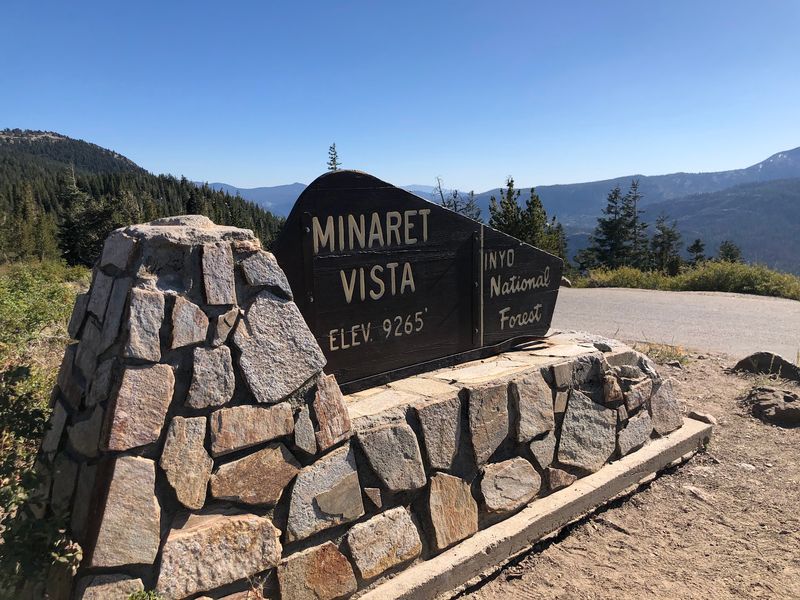
Jagged peaks that look like a row of shark teeth greet you a few steps from the lot. Minaret Vista sits on a high mountain pass near Mammoth Mountain in the Eastern Sierra.
A short walking trail and terrace lead to the overlook. The walk is quick, and the view hits almost right away.
Looking west, you get a sweeping 180-degree panorama. The Minarets and the Ritter Range dominate the skyline, with wilderness and valley spread below.
You can even look down toward the Devils Postpile area. It’s a neat bird’s-eye angle on one of the region’s best-known landmarks.
After dark, the scene changes completely. Clear nights can bring skies packed with stars, making this a strong pick for stargazing.
The vista stays open 24 hours, and restrooms are available. Friday and Saturday evenings tend to be busiest.
Fall is a lovely time to plan a visit. Eastern Sierra color can pop in nearby canyons, though timing varies year to year.
Bring layers, since mountain air cools quickly. The view is worth a few goosebumps.
Address: Lookout Point Rd, Mammoth Lakes, CA 93546
7. Point Dume, Malibu, CA
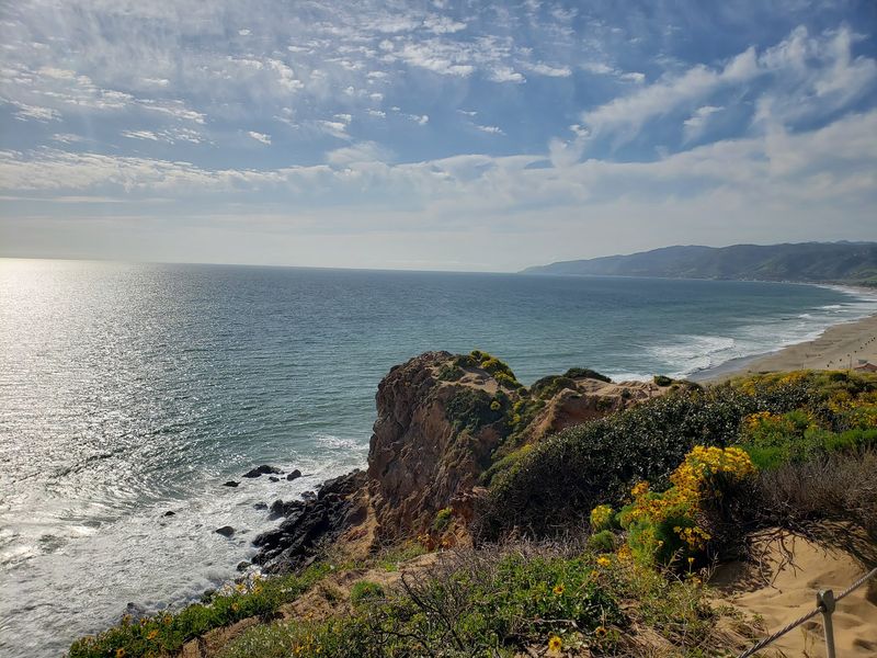
Whale watching from a bluff top beats a boat ride if you get seasick. Point Dume offers coastal trails and cliffs where migrating whales may appear offshore.
The main climb is a short hike up a small hill. From the top, the Pacific stretches out in a wide panorama.
Santa Monica Bay curves along the coast below. On clear days, you can look out toward Santa Catalina Island.
Keep your eyes on the water. Sea lions, dolphins, and surfers riding waves can all show up in the scene.
Rocky coves add texture to the shoreline. If the short climb leaves you wanting more, the trail continues for extra exploring.
Winter is a smart season to visit. Gray whale migration along the California coast can make the bluffs extra exciting.
Hours run from 5 AM to 7 PM daily. Weekend afternoons and evenings draw the biggest crowds, so a weekday morning may feel more peaceful.
Parking includes free and paid lots, and restrooms are available. It’s an easy outing for kids, too.
The setting feels tranquil for a Malibu shoreline. Bring a light layer for the ocean breeze.
Address: Cliffside Dr & Birdview Ave, Malibu, CA 90265
8. Sunset Cliffs Natural Park, San Diego, CA
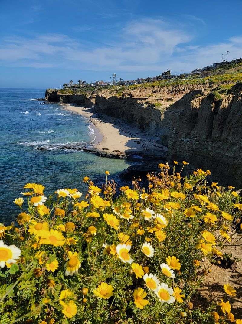
The name isn’t subtle, and it doesn’t need to be. Sunset Cliffs Natural Park lines the western bluffs of Point Loma with rugged sandstone cliffs above the Pacific.
The park covers about 68 acres of coastal land. Level shoreline paths let you wander without any steep climbs.
Ocean views open up almost immediately. Waves crash below the bluffs, and the horizon feels endless.
Bring a blanket and stake out a patch of ground before evening. There’s plenty of room to spread out and wait for the sky to light up.
Once in a while, a cliff diver may appear along the rocks. Watching from a safe distance is the way to go.
Dogs are allowed, and you’ll find cycling lanes plus a public restroom. Picnics fit right in here.
The park stays open 24 hours. Saturday and Sunday evenings bring the biggest crowds, while weeknights are often calmer.
Parking includes free lots, street spots, and paid options. Stay well back from the edges, since sandstone can be fragile.
For a San Diego evening, it’s hard to beat. Golden light on sandstone puts on quite a show.
Address: Ladera St, San Diego, CA 92107
9. Glacier Point
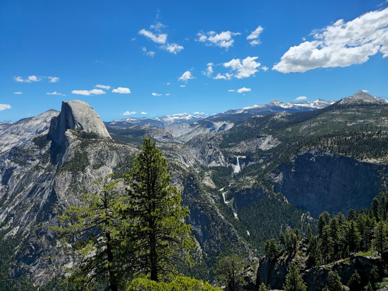
Standing 3,200 feet above Yosemite Valley usually takes serious climbing. At Glacier Point, a paved path from the parking lot does the work for you.
The overlook sits at 7,214 feet. The walk is mostly level and wheelchair accessible, and an easy stroll covers it in about 20 minutes.
Half Dome steals the spotlight right away. Nevada Fall, Vernal Fall, and Yosemite Falls join the lineup, seen from above.
Educational placards explain the landscape as you go. A small gift shop sells snacks, ice cream, and cold drinks, and clean restrooms are close by.
Despite the name, you won’t find a glacier here today. The ice that shaped this scenery melted away long ago.
Sunrise is a great time to visit. Early light on Half Dome makes the drive worth the alarm clock.
You can drive up or hike in, and trails branch off for longer outings. Parking is free.
Check road and seasonal conditions before heading out. In California’s high country, plans can change with the weather, so a backup idea never hurts.
Address: Glacier Point Rd, Yosemite National Park, California
10. Mendocino Headlands State Park
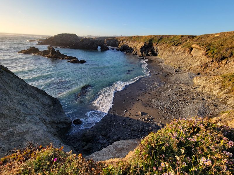
A storybook village with sea caves for a backyard sounds made up. Mendocino Headlands State Park wraps right around the small historic town of Mendocino.
Level paths wind across the bluffs, so the walking stays gentle. You’ll get ocean views within moments of setting out.
Sea caves and natural arches line the coast below. The Pacific crashes against the rocks with plenty of drama.
The park sits within a larger 7,400-acre wildlife corridor with miles of cliffside trails. Secluded beaches sit below the headlands.
Slow down at the overlooks. The arches look different with each shift in the tide and light.
Wind can pick up along the bluffs, so pack a jacket. Northern California coastal weather likes to keep you guessing.
Picnic tables and public restrooms make a longer stay easy. Dogs are welcome, and the trails suit young walkers.
Hours run from 8 AM to 5 PM daily. Saturday afternoons tend to be busiest, while weekday mornings are often quieter.
The coastal drive is part of the fun. Pair the walk with a stroll through town for a classic North Coast day trip.
Address: Mendocino, CA 95460
11. Morro Rock
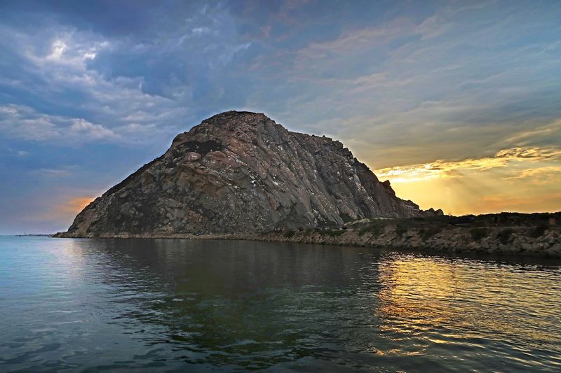
A 581-foot volcanic plug guards the harbor entrance in Morro Bay. The rock formed from ancient magma and remains the town’s signature landmark.
Getting close requires almost no effort. Flat coastal pathways and harbor-side routes lead from the bayside lot right up to its base.
From there, ocean and harbor views spread out on both sides. Seagulls wheel overhead, and beaches stretch along the shore.
A rocky walk out toward the tip of the bay adds a bit of adventure. It still feels more like a stroll than a hike.
Pack a lunch and enjoy it with the view. Parking near the rock makes it easy to linger.
Beachcombers can search the sand for sand dollars. Rock stacking along the shore is another relaxing way to pass time.
The rock looks different with each change in light. Fog can wrap it one hour and lift the next.
Evenings can bring beautiful sunsets over the Pacific. The small town nearby is friendly and easy to explore after your walk.
Morro Bay sits in San Luis Obispo County on California’s Central Coast. It’s an easy add-on to any Highway 1 road trip.
Address: Morro Bay, CA 93442
12. Lands End Trail, San Francisco, CA
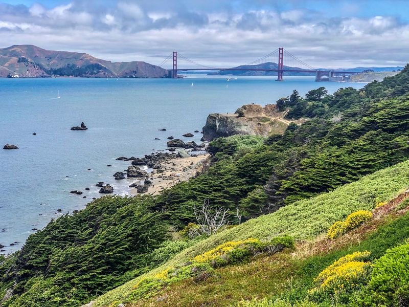
San Francisco saves one of its best views for its rugged northwest corner. Lands End Trail follows rocky bluffs where the city meets the Pacific.
The walking is relatively easy, with a few gentle climbs. Broad views start just minutes after you leave the lot.
The Golden Gate Bridge and Marin Headlands appear across the water. The open Pacific fills the rest of the horizon.
Several viewpoints line the route, so you can stop as often as you like. Pick a favorite and linger.
Keep the trip short or keep going. The path lets you set the pace.
Sunsets here can be spectacular. Evening light over the ocean can turn the cliffs and water a deep gold.
The trail stays open 24 hours, and parking is free. Saturdays draw crowds from morning to evening, while Wednesday mornings tend to be quiet.
Dogs are allowed outside on the trail. Bring a layer, since the coastal wind can surprise you.
For locals, it’s an easy after-work escape. For visitors, it’s proof that a big city can still feel wild.
Address: Lands End Trail, San Francisco, CA 94121
13. Torrey Pines State Natural Reserve, La Jolla, CA
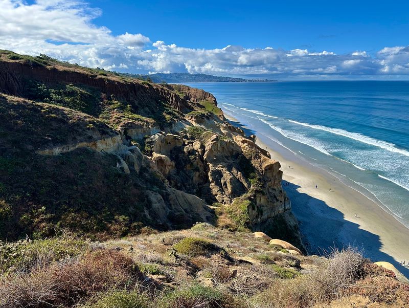
Rare Torrey pine trees cling to the bluffs here, and they give the reserve its name. Torrey Pines State Natural Reserve crowns the coast just north of San Diego in La Jolla.
The Guy Fleming Trail makes a great starting point. It’s an easy loop that leads straight to coastal overlooks.
Panoramic views stretch across the Pacific. Sandstone formations add striking shapes to the scenery along the way.
Keep an eye on the water below. Dolphins sometimes appear offshore, and an occasional bobcat may roam the reserve.
Guided tours run about 1.5 to 2.5 hours. They cover the area’s history, geology, and native plants, including the Torrey pines themselves.
The trails are well kept and kid-friendly. Restrooms, including a gender-neutral option, are available.
The reserve is open daily during daylight hours. Weekend afternoons tend to be busiest, so an early start pays off.
Parking includes free and paid lots plus street spots. A secluded beach sits below if you want to keep exploring.
It’s a fitting finale for this list. A rare tree, a big ocean, and barely a drop of sweat.
Address: 12600 N Torrey Pines Rd, La Jolla, CA 92037