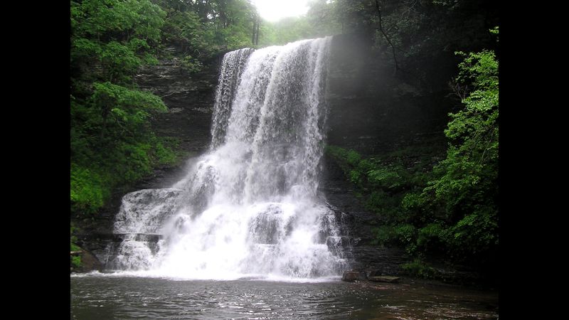
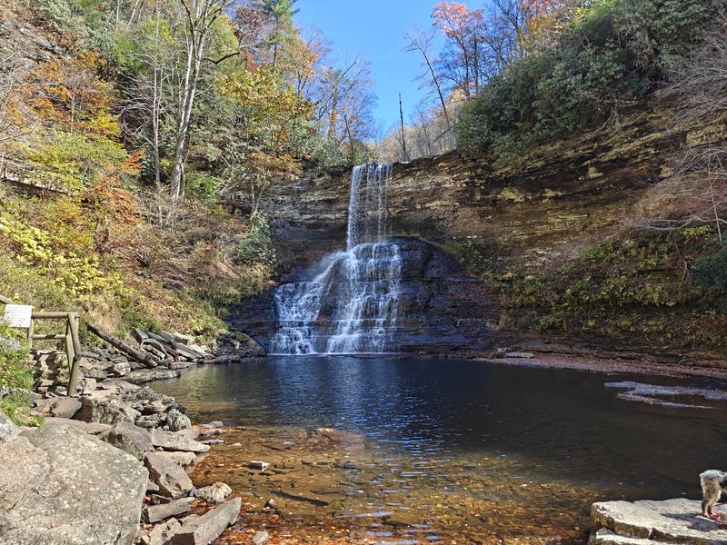
A waterfall in the Virginia mountains drops roughly 66 to 69 feet, depending on which sign or guidebook you trust. Either way, it pours between cliff walls that tower about 200 feet over the pool below.
Getting there takes a two-mile walk beside a cold, clear trout stream. You’ll cross wooden bridges, climb stone steps, and pass little cascades that keep trying to steal the show.
I like how the trail gives you two choices for the trip. One path hugs the creek and its rocks, while the other climbs gently through the forest above it.
The best part might be the ending, when mist reaches your face before the full view does. I can’t imagine a better reward for tired, sweaty legs on a summer day, so which route would you pick first?
A Mountain Waterfall Hike Waiting in Giles County
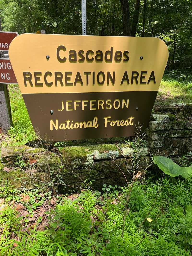
Officially, the path is called the Cascades National Recreation Trail, though most people just say Cascade Falls. Its trailhead sits in the Cascades Day Use Area near Pembroke, Virginia, in Giles County.
The USDA Forest Service manages the land as part of the George Washington and Jefferson National Forests. That means you’re hiking on public forest, not a private attraction with a gift shop and a ticket booth.
On maps, you’ll also see it listed as Cascades Trail, Forest Trail #70. Same trail, same waterfall, just a more bureaucratic nickname.
The setup is refreshingly simple. You park, find the trail, and follow the water uphill for about two miles until the falls appear.
Online, the trailhead holds a 4.9-star rating across more than 1,600 Google reviews. Numbers like that are rare for anything, let alone a walk that ends in cold spray and wet sneakers.
Giles County sits in the southwestern part of the state, surrounded by ridges and forest. The Cascades make a strong argument that this corner of Virginia deserves a spot on your summer map.
Sixty Years of Bridges, Floods, and Fresh Starts
Workers first built the original trail back in the 1960s. Generations of hikers have followed Little Stony Creek to the falls ever since.
Then 1996 happened. A major flood tore through the area and badly damaged sections of the trail and its bridges.
Rather than abandon it, crews rebuilt and rerouted parts of the path. The bridges and stone steps you cross today are part of that recovery story.
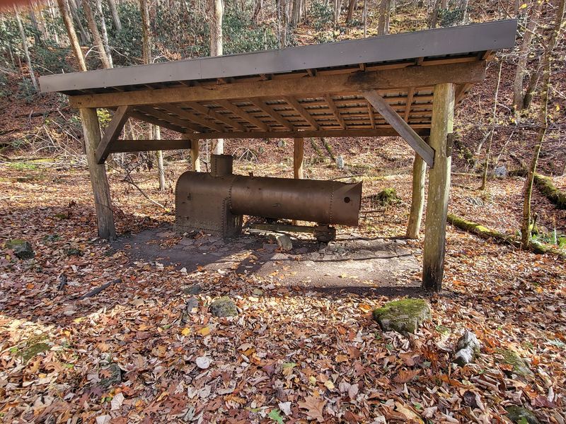
Keep your eyes open for an older chapter, too. An old boiler from a sawmill that operated in the 1920s and 1930s still sits along the trail.
It’s a quiet reminder that these woods once looked very different. Logging shaped much of the region before the forest grew back into the green tunnel hikers enjoy now.
I love that a single walk mixes a flood comeback with a leftover piece of industrial history. You get scenery and a small history lesson without reading a single plaque.
Kids especially tend to find a giant rusty boiler in the middle of the forest pretty fascinating. Honestly, adults do too, even if they pretend otherwise.
The Great Height Debate at the End of the Trail
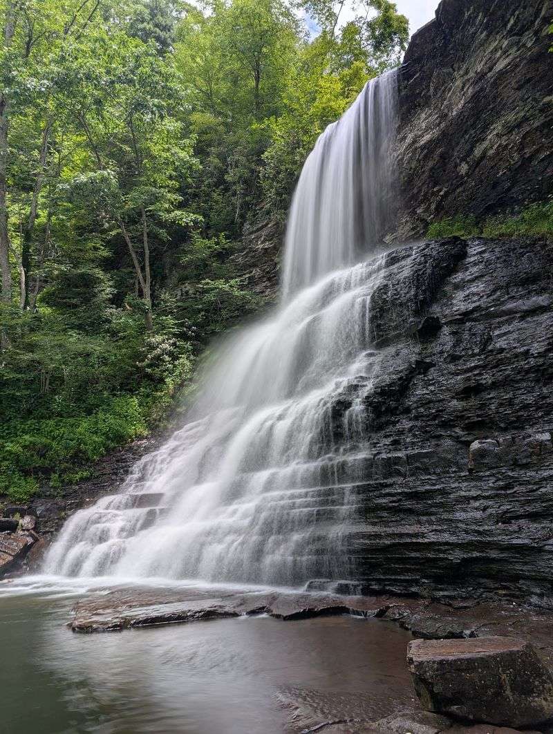
Sixty-nine feet or sixty-six? That depends on who you ask, and the waterfall doesn’t seem to care either way.
Older tourism listings, including the description tied to the trailhead, say 69 feet. The managing forest, the Virginia Department of Wildlife Resources, and several hiking guides list it at 66.
Three feet won’t change your reaction when it comes into view. Water drops in a bright white curtain into a pool surrounded by rock.
What really makes the scene feel huge is the setting. Cliff walls rise about 200 feet around the falls, creating a natural amphitheater of stone.
Mist drifts off the base on most days, so expect a little spray. After a good rain, the flow gets noticeably stronger and louder.
Big boulders near the bottom give you places to sit and stare. Plan to linger, because rushing this view feels like leaving a movie right at the best scene.
Bring a towel or a spare shirt if you like getting close. That spray adds up faster than you’d expect.
Little Stony Creek Steals Plenty of Attention
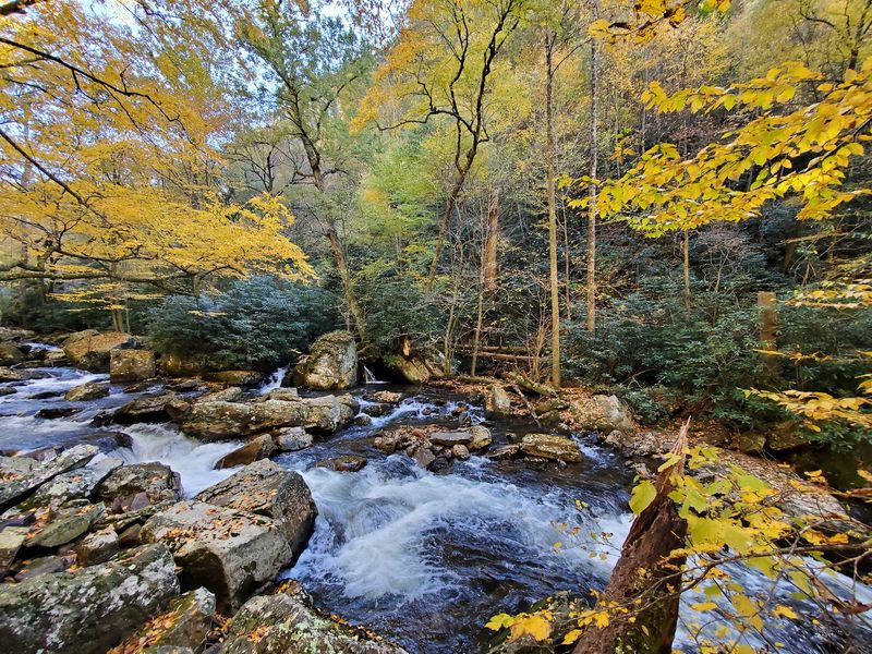
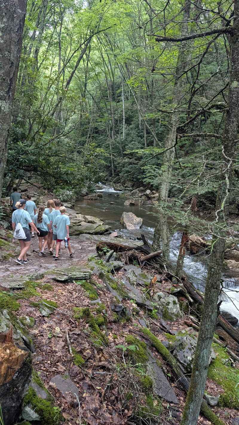
Honestly, the creek deserves its own fan club. Little Stony Creek runs beside the trail for most of the way, and it’s a native trout stream.
That clear water tumbles over rocks, forming small cascades and rocky pools along the route. Every bend seems to offer one more scene worth a photo.
You won’t spend two miles staring at your feet in a dark tunnel of trees. The stream keeps you company, adding sound and movement the whole way up.
Massive boulders and rock formations sit scattered through the water and along the banks. They give the trail a wild, rugged look that changes every few minutes.
Families often stop at the shallow edges so kids can dip their toes in. Fair warning, the water runs cold, even when summer heat feels intense.
Respect the trout habitat while you explore. Stay off fragile banks when you can, and leave rocks where you found them.
If the falls are the main event, the creek is the opening act that refuses to be ignored.
Choose the Lower Trail for Water at Your Elbow
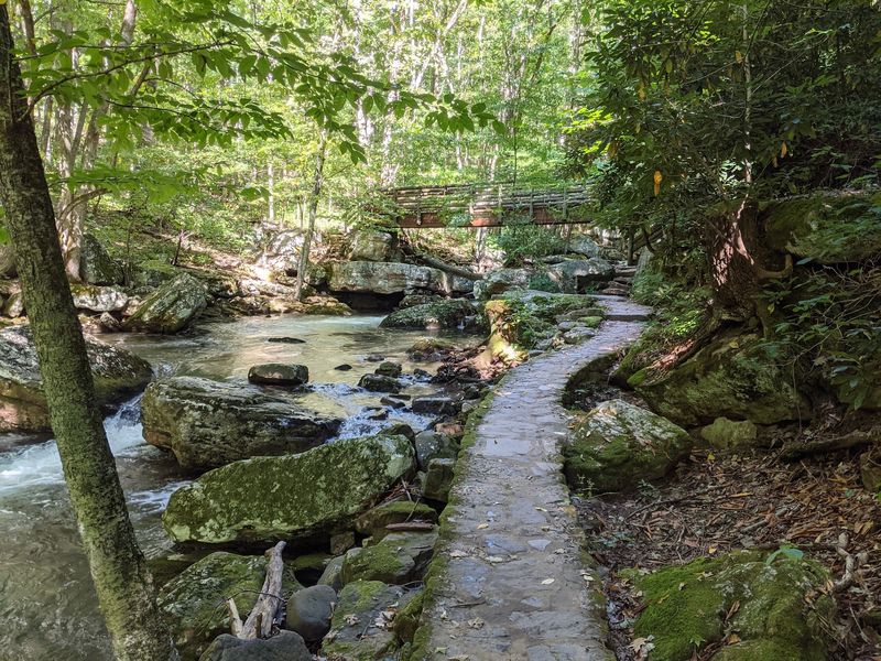
Creek lovers, this route is yours. The Lower Trail stays close to the water, so the little falls face you as you climb.
It’s the narrower of the two options and the more rugged one. Expect stone steps, roots, rocks, and a few wooden bridges across the stream.
Uneven rock stairs show up often, both going up and coming down. Anyone with balance issues may find the Upper Trail a better match.
Near the falls, the path gets rockier and starts to feel like a scramble over boulders. Good grip on your shoes matters here more than anywhere else.
The payoff is constant scenery. You’re beside the water nearly every step, with pools and mini cascades appearing like rewards.
Many hikers pick the Lower Trail going up for that reason. Climbing rocky steps feels easier on the knees than descending them.
Take your time and use your hands when needed. Slick rock near moving water doesn’t reward speed, and nobody is handing out medals at the top.
Why the Upper Trail Feels Like a Breather
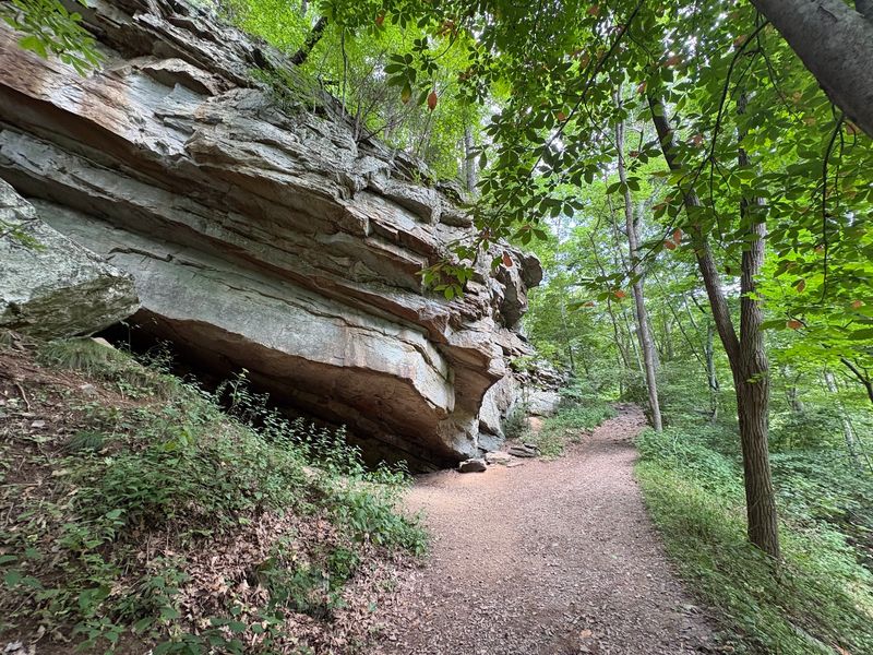
Smoother footing, fewer surprises. The Upper Trail climbs through the forest above the creek on a wider path.
Its surface is mostly dirt and gravel, with only a few large rocks to navigate. Plenty of hikers treat it as the easier half of the trip.
You’ll trade some of the creek views for a calmer walk under tall trees. Birdsong and shade make that trade feel pretty fair.
It still involves climbing, so don’t expect a flat stroll. The grade simply feels more gradual than the rock steps along the water.
This route works well for anyone recovering from an injury or managing tired legs. Rest points along the way help, too.
A popular plan is heading up the Lower Trail and returning along the Upper Trail. That combo gives you scenery first and easier footing when you’re worn out.
Watch the trail signs where the paths meet. Near the junction, a sign points toward the parking lot two miles back and the falls ahead, so you won’t get turned around.
Four Miles, Two Routes, One Loop Worth Planning
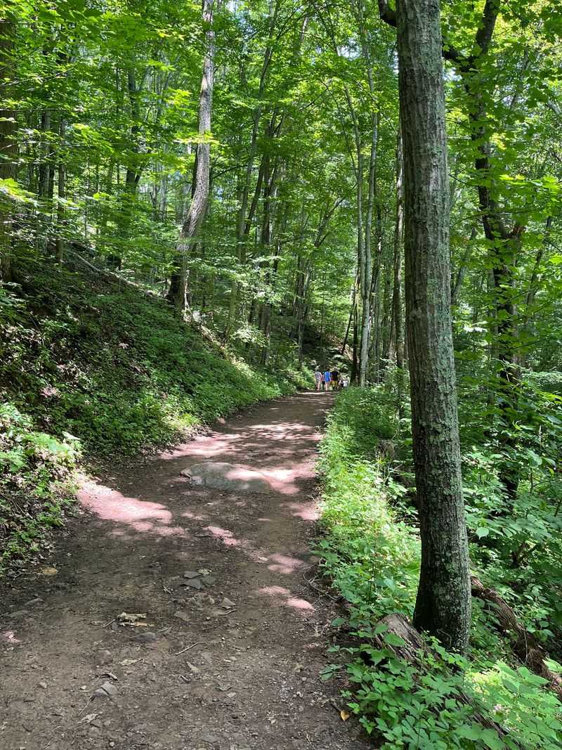
Round trip, the hike covers about four miles. You can do it as an out-and-back or as a loop using both trails.
Elevation gain lands somewhere around 663 to 800 feet. That rates as moderate, which feels about right for most reasonably active people.
Plenty of hikers finish the full trip in roughly two hours. Add more time if you plan to linger at the falls or stop for creek breaks.
Going clockwise usually means an easier, more gradual climb. Heading counterclockwise puts you on the rockier, rootier section first.
There’s no wrong answer, just different flavors of effort. Some people love tackling the hard part fresh, while others prefer saving it.
Bring more water than you think you need. Summer humidity in the Virginia mountains can turn a moderate hike into a sweaty one fast.
A small snack for the falls makes a nice reward. Pack out every wrapper, because these woods look best without trash on the trail.
Comfortable hiking boots beat white sneakers every single time here.
The Honest Truth About Swimming Under the Falls
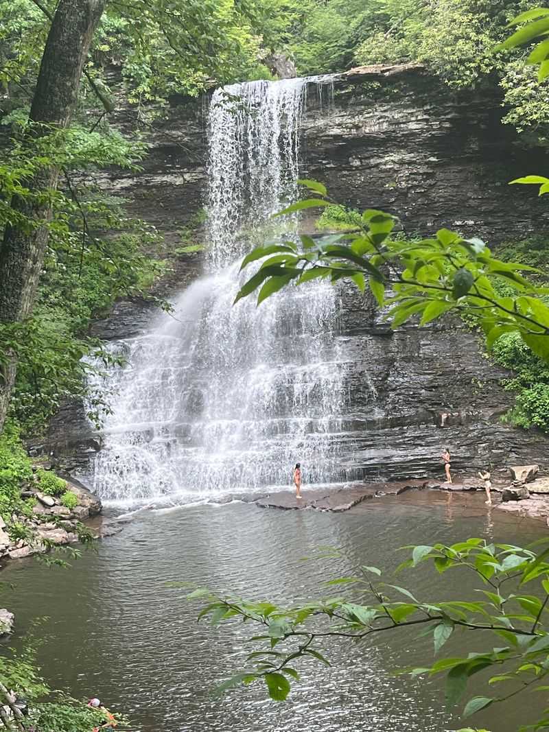
Let’s talk about that swimming dream in the headline. Plenty of people do take a dip, but official guidance points in a more careful direction.
Posted signs have warned that swimming below the falls is extremely dangerous because of strong current and undertow. The forest’s policy encourages swimming at designated swim beaches only.
A forest order also prohibits swimming outside designated swimming areas within developed recreation areas. No designated swimming zone at the falls has been confirmed.
So before you pack a swimsuit, check with the local ranger district. They can tell you what water access is currently allowed.
Even wading carries risk here. Rocks around the pool get slick, and the water runs icy cold most of the year.
Feeling the mist on your face is completely free and totally safe. Standing near the base, you’ll still get that refreshing blast of cool spray.
Shallow creek edges along the trail can offer a gentler way to cool your feet. Just watch your footing and keep little ones close.
Frozen Curtains in Winter, Butterflies in Spring
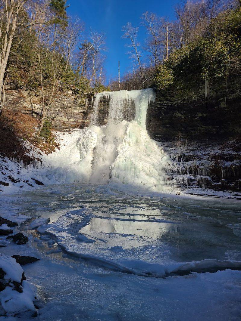
Summer gets the attention, yet winter quietly puts on a stunning show. When temperatures drop low enough, the falls freeze into ice formations against the cliffs.
The trail stays open year-round, so cold-weather visits are possible. Icy rocks demand extra caution, and traction gear can help.
Spring and summer bring a softer kind of magic. A wildflower garden near the restrooms and parking attracts butterflies during those warmer months.
It’s a lovely little bonus before you even reach the trail. Stop for a minute and see who’s fluttering around the blooms.
Timing your visit after rain pays off, too. Heavier flow makes the waterfall thunder louder and look more dramatic.
Autumn is another strong choice in these hardwood forests. Cooler air makes the climb more comfortable for many hikers.
Every season changes the trail’s personality a bit. I think that’s a great excuse to come back more than once.
Check weather before heading out, since storms can turn the creek fast and slick up the rocky sections in a hurry.
Neighbors With Fur, Feathers, and Antlers
Deer, owls, and black bears all call this part of the forest home. Spotting wildlife is common in the area, so keep your eyes open.
Deer often show up quietly at the edges of the woods. Owls are more likely heard than seen, especially closer to dusk.
Black bears deserve respect and plenty of distance. Never feed them, and keep food packed away while hiking.
Making a little noise on the trail helps avoid surprise encounters. Most bears want nothing to do with chatty hikers anyway.
Smaller creatures add charm, too. Butterflies drift through the clearings, and birdsong fills the tree canopy on calm days.
Mushrooms pop up along the forest floor after wet weather. Look all you want, but leave them be.
Native trout swim in Little Stony Creek, adding life beneath the surface. Kids love searching the clear pools for anything that moves.
Treat every animal as a guest host. Watching quietly gives you better views and keeps the forest healthy for the next visitor.
Good News for Families and Weekend Wanderers
Toddlers, teens, and grandparents can all make this hike work with a little planning. The trick is picking the right route for your crew.
Little ones often stay entertained by the creek, bridges, and boulders on the lower route. Heading back on the wider path keeps tired legs happy.
Older kids tend to treat the rocky sections like a natural obstacle course. Just keep an eye on them near slippery stones.
Anyone needing gentler terrain can stick to the Upper Trail. Rest spots along the way allow plenty of breaks.
Picnic tables near the trailhead make a great finish line for lunch. Packing sandwiches turns the outing into a full day.
Solo hikers and couples get plenty from the trail, too. Quiet mornings feel peaceful, with only birds and water for company.
Sturdy shoes matter for everyone in the group. Rocky, wet surfaces can ruin flimsy footwear quickly.
Bring layers, a little patience, and a camera. Something about those bridges makes everyone want a group photo.
Parking, Passes, and the Sunset Rule
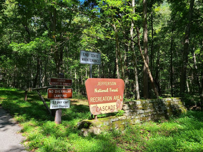
Plug 2068 Cascade Drive, Pembroke, VA 24136 into your map app to reach the Cascades Day Use Area. The trailhead starts right from there.
A small daily parking fee applies per vehicle. Interagency passes like America the Beautiful and the forest Seasonal Day Use Pass are accepted.
Virginia State Parks passes don’t work here, since this is national forest land. Plan accordingly before you arrive.
The area is open year-round as a day-use site. Visitors need to leave before sunset, so start early enough to finish comfortably.
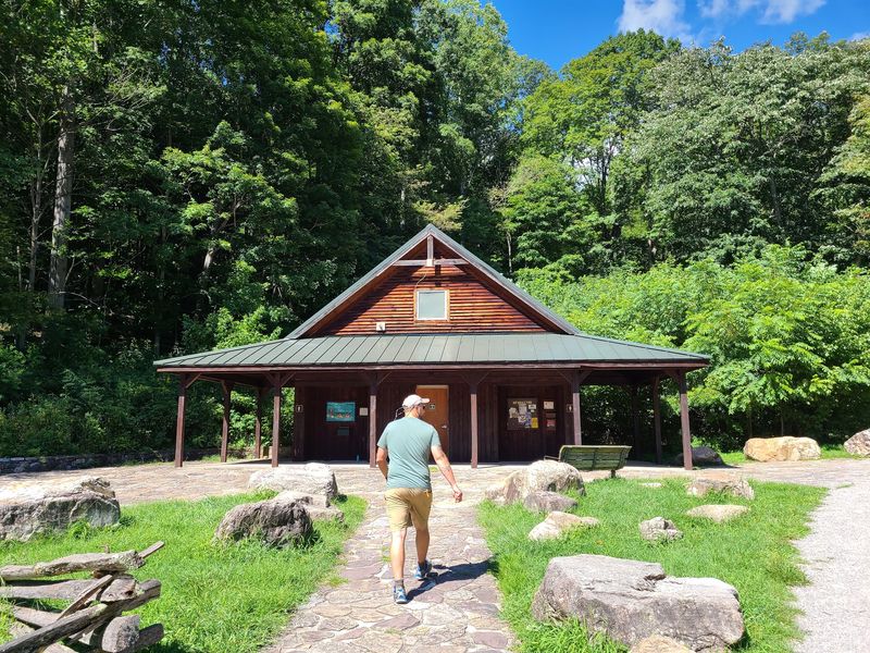
Facilities near the trailhead include flush toilets and potable water in the restrooms. Picnic tables sit nearby for snacks before or after the hike.
Parking can fill quickly on weekends, especially in warm weather. Arriving early gives you a better shot at a spot.
Please park only in proper spaces. Blocking areas near the restrooms or other restricted spots creates headaches for everyone.
Download directions ahead of time if mountain roads tend to weaken your phone signal.
A Mountain Walk That Earns Every Ounce of Effort
Few hikes manage to stay beautiful from the first step to the last. The Cascades National Recreation Trail pulls that off with surprising ease.
You get a clear trout stream, sturdy wooden bridges, and plenty of rocky drama. Then comes a waterfall framed by towering cliffs.
The two-route setup means you can customize your effort. Rugged creekside scrambling and gentler forest walking both lead to the same reward.
Yes, swimming dreams need a reality check. Confirm the current rules with the ranger district, and enjoy the mist either way.
Cascade Falls also shines across seasons, from butterfly-filled summers to icy winter displays. One visit rarely feels like enough.
Practical touches like restrooms, picnic tables, and simple parking make the day easy. Arrive early and the experience gets even better.
For anyone exploring southwestern Virginia, this trail belongs near the top of the list. I believe it’s the kind of outing that turns casual walkers into regular hikers.
Lace up your boots, fill your water bottle, and let the creek lead the way.