Thirty-two miles of pavement, and not a single car allowed on any of it. That alone made me sit up.
In 2006, one national trail website voted this river path the number one bike path in the country.
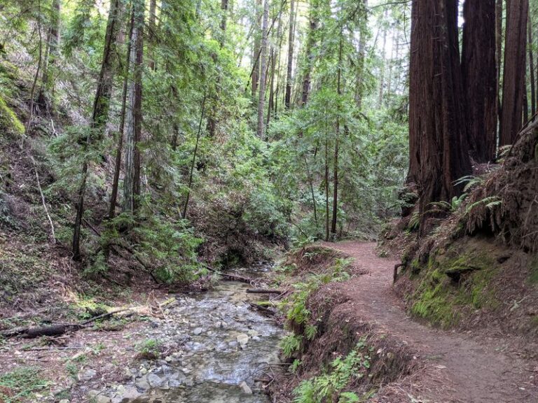
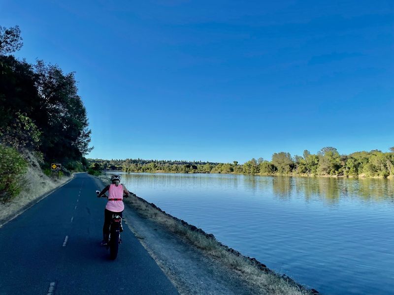
The route follows a river through shady woods, open fields, and quiet parks. About half of it sits under trees.
The other half can open up to wildflower views and wide skies.
I like how it works for everyone. Road cyclists, joggers, families on trikes, and casual walkers all share it.
Some people even use it to get to work in California’s capital region.
It starts near downtown and ends at the edge of a big foothill lake. Bridges, mile markers, and water fountains dot the way.
So how far would you ride before turning back?
A Car-Free Ribbon Linking Downtown To A Foothill Lake
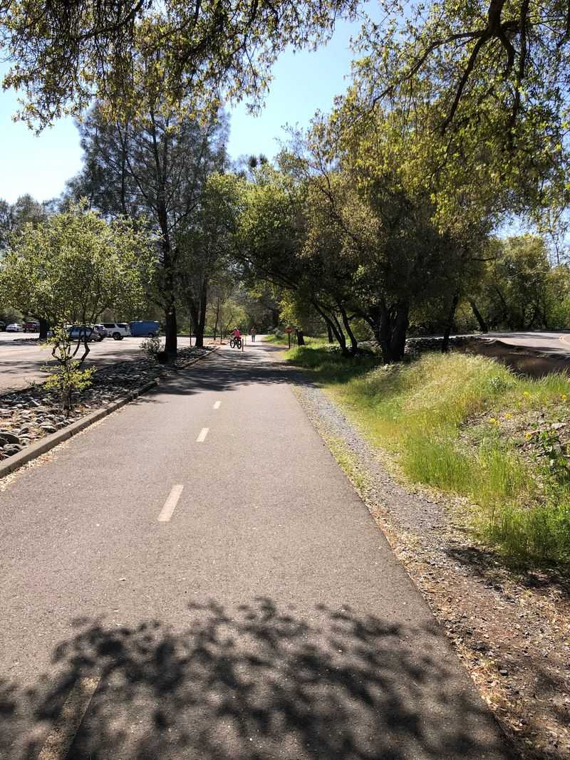
Officially, it’s called the Jedediah Smith Memorial Trail. Most Sacramento folks simply call it the American River Bike Trail, and nobody seems to mind.
The paved path runs 32 miles between Discovery Park in Sacramento and Beal’s Point at Folsom Lake. Cars can’t use any of it, which is a rare luxury in California.
That length means you get to choose your own adventure. Some riders tackle the full stretch, while others pedal a few miles and call it a great morning.
The trail is a multi-use path, so it welcomes more than bikes. Runners, walkers, and inline skaters all share the pavement here.
It also works as a practical route, not just a weekend toy. Commuters use it as a major artery, swapping traffic jams for river views.
The path follows the American River Parkway for most of its length. That gives you a green corridor right through a busy metro area.
Honestly, it feels a bit like the city forgot to pave over its best backyard. Lucky for everyone, it stayed that way.
Planning a ride? Knowing both ends helps a lot, and we’ll get to those soon.
How A Mountain Man’s Name Ended Up On A Bike Path
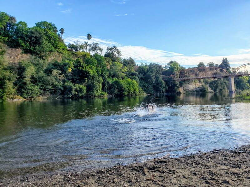
Jedediah Smith was a famous fur trapper and explorer of the American West. His name now graces a path built for bicycles, which feels like a fun twist of fate.
Recognition for the trail came early. In 1974, it was named a National Recreation Trail, a federal designation for standout routes.
That’s more than 50 years of status for this California treasure. Plenty of trails come and go, but this one keeps earning respect.
Then came 2006. That year, voters on Trails.com named it the Number One bike path, and Sacramento got serious bragging rights.
Today, Sacramento County manages most of the route. California State Parks oversees the northernmost 8.4 miles near Lake Natoma.
Along that state-run stretch, you’ll often hear it called the American River Bikeway. Same pavement, different name, so don’t let the signs confuse you.
I believe that long history is part of the charm. Riding here means joining generations of locals who pedaled the same river bends.
In a region that changes fast, a trail with this kind of staying power feels like a small act of preservation. That alone makes it worth a visit.
Your Ride Kicks Off Where Two Rivers Meet
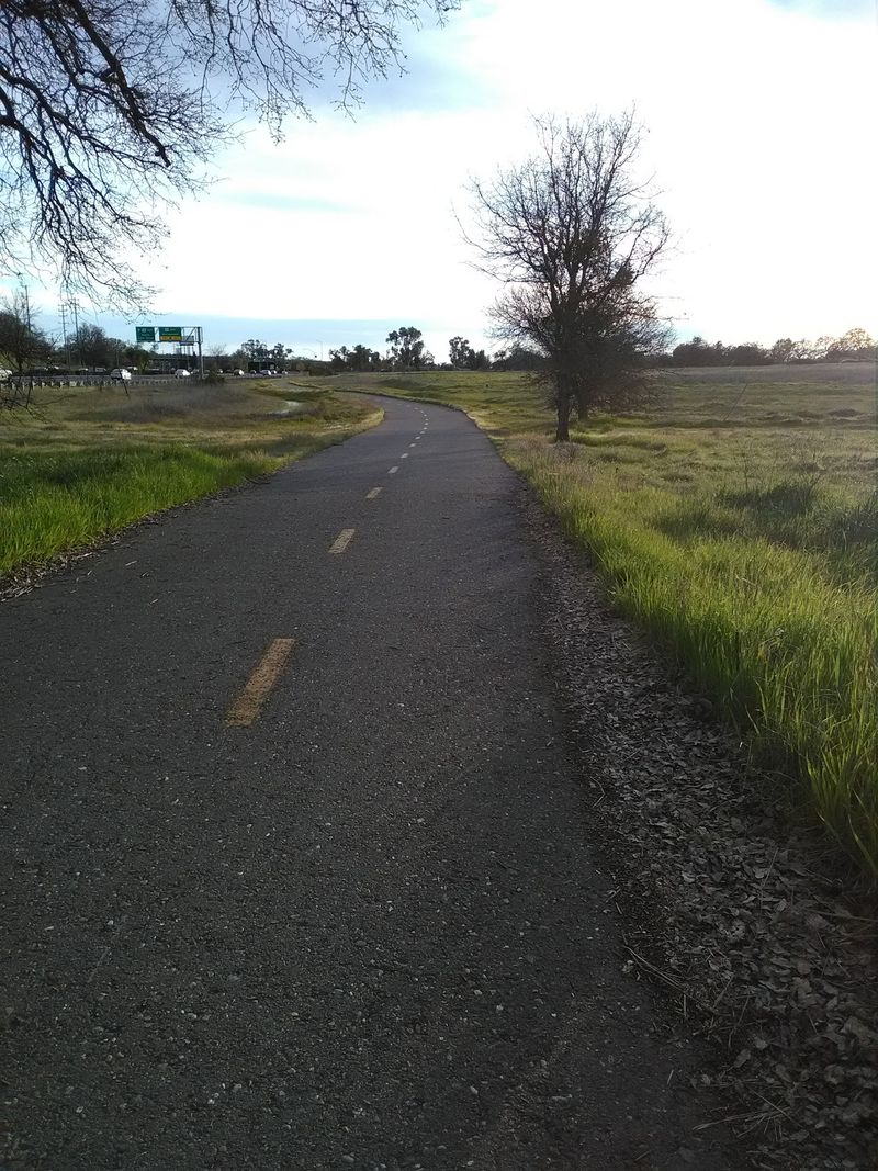
Start at the western end, and you’ll find Discovery Park. It sits at Jibboom Street and Natomas Park Drive, close to downtown Sacramento.
The park’s address is 1600 Garden Highway, Sacramento, CA 95833. Plug that into your map, and you’ll land right near mile zero.
Discovery Park makes a handy launch point for city riders. You can roll out from here and head east toward the foothills.
On the opposite end, the trail finishes at Beal’s Point Recreation Area. That spot sits near Folsom Lake in Granite Bay.
Many riders pick one end and do an out-and-back trip. Others start somewhere in the middle, since the path passes plenty of parks.
Mile markers along the route help you track progress. That matters when you promised yourself ten miles and your legs suggest otherwise.
Trailside maps also help you figure out where you are. Getting lost here is tough, but a map never hurts.
A smart plan is to decide your turnaround point before you start. Every mile you ride out is a mile you ride back, after all.
Shade, Sunshine, And A River That Keeps You Company
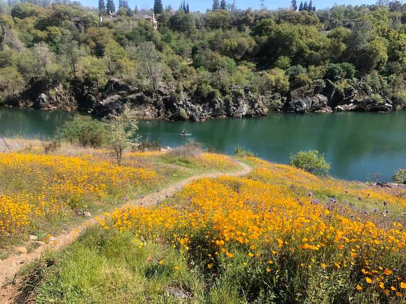
Summer in the Sacramento Valley can get hot. Thankfully, roughly half of this route is shaded by trees.
The path winds through riparian habitat along the American River. Riparian simply means the green, leafy zone next to moving water.
In the open sections, things change. You may see fields of wildflowers stretching out beside the pavement.
That mix keeps the ride from feeling repetitive. One mile feels like a cool forest tunnel, and the next opens up wide.
Riders often praise the shady stretches and the wide path. There’s room for bikes, trikes, and people on foot to share comfortably.
Diverse landscapes come up a lot, too. The main trail follows the river, but side paths branch off for more exploring.
Timing still matters on hot days. Early mornings can feel much kinder than a blazing afternoon in July.
Bring water anyway, even with the fountains along the route. A full bottle beats searching for the next fountain when you’re thirsty.
Sunsets get a mention too. Golden light over the river is a pretty good reward for your final miles.
Bridges Worth Pausing On
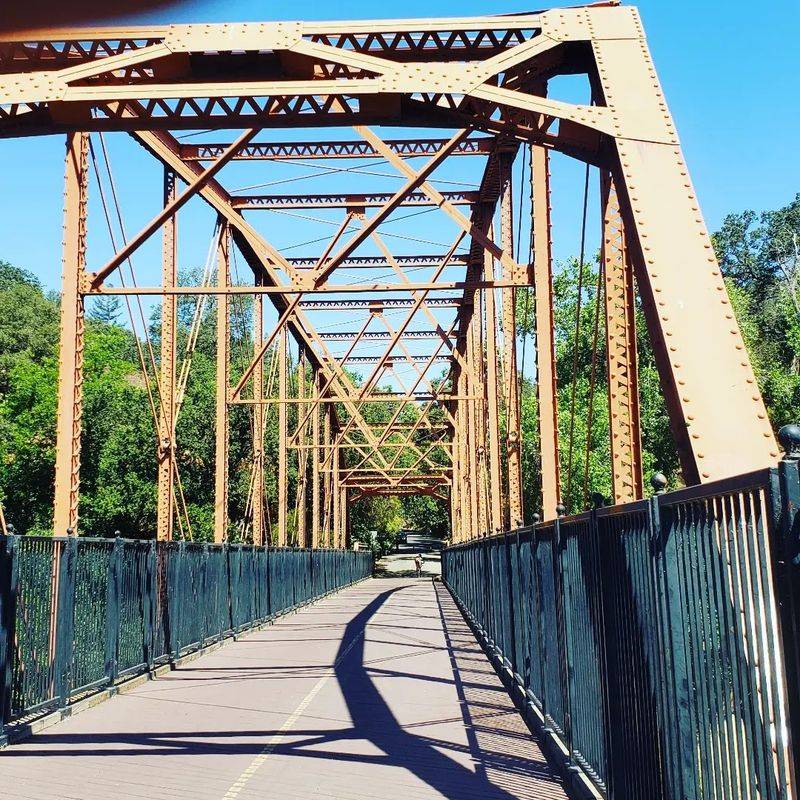
Bridge fans, this trail was made for you. Several pedestrian bridges cross the river along the route.
The Guy West Bridge is a suspension bridge with real presence. It connects the trail to the California State University, Sacramento, campus.
Students and riders both use it, which makes sense. Who wouldn’t want a scenic shortcut to class?
Farther along, the historic Fair Oaks Bridge offers another crossing. It links the trail with the Fair Oaks area on the river’s other side.
The Harold Richey Memorial Bridge is another named crossing worth knowing. Each bridge gives you a fresh angle on the water below.
Up near Folsom, the Folsom Pedestrian Bridge does a special job. It gives riders access to Historic Folsom.
Bridges also make natural rest stops. You can catch your breath and enjoy the view without feeling lazy.
I can’t imagine riding past all of them without snapping a photo or two. The river looks different from every crossing.
Planning a loop? Bridges let you cross to connecting paths, so check a trailside map before you commit.
Parks That Pop Up Like Rest Stops
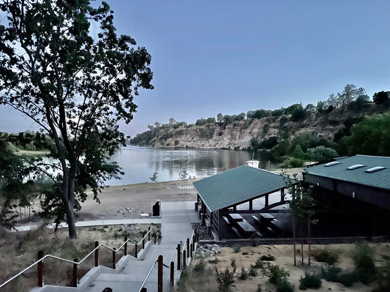
Pedal long enough, and you’ll pass a whole string of parks. They break up the miles in the nicest way.
William B. Pond Recreation Area is one of the stops.
River Bend Park and Hagan Community Park also sit along the route.
Sunrise Recreation Area is another familiar name on the trail. Closer to the city, Sutter’s Landing Park joins the lineup.
These parks give you options. You can start at one, end at another, or simply stop for a snack break.
Restrooms appear at various points along the trail. That’s a big deal on a long ride, especially with kids.
Water fountains help too. Refilling without leaving the path keeps your momentum going.
Families can use the parks to shape shorter rides. A few miles between two parks makes a manageable outing for young legs.
Picking your own start point also helps with parking plans. Different parks suit different neighborhoods across Sacramento County.
Think of the trail like a necklace. The path is the string, and each park is a bead worth stopping at.
Watch For Squirrels, Horses, And The Occasional Snake
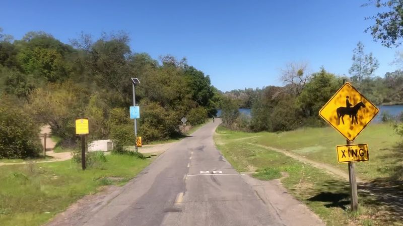
Wildlife along this trail is part of the deal. The river corridor supports a wide variety of animals.
Squirrels may dart across the path at the last second. Consider them tiny, fluffy speed bumps with zero traffic sense.
Rattlesnakes have also been spotted crossing the trail. Keep your eyes on the pavement, especially on warm days.
Horses sometimes share parts of the parkway too. They can spook around bikes, so slow down and give them space.
A calm voice and an easy pass go a long way. Nobody wants a startled horse on a narrow stretch.
Birders might enjoy the river setting as well. Riparian areas often draw birds, though sightings always depend on luck and timing.
Wildlife sightings can turn an ordinary ride into a story. Just enjoy them from a safe distance.
Kids especially love spotting animals along the way. It turns a long ride into a moving nature walk.
One tip feels obvious but matters. Stay alert, keep your speed reasonable, and let nature have the right of way.
Lake Natoma Brings Calm Water And A Detour To Old Folsom
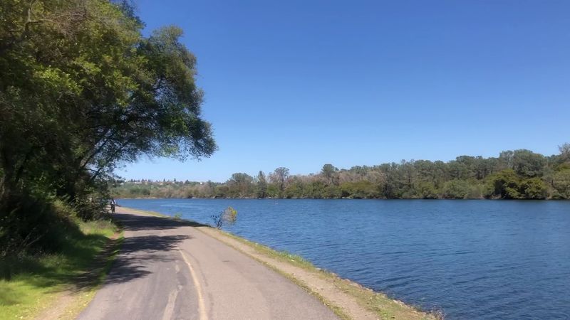
Near the eastern end, the scenery shifts. The trail runs along the north side of Lake Natoma.
Calm water here draws paddlers and rowers. The Sacramento State Aquatic Center sits on this stretch and offers calm-water activities.
Bikes not enough? The aquatic center gives you a different way to enjoy the same pretty setting.
This section falls under California State Parks. It’s often called the American River Bikeway here.
Then comes the fun detour. The Folsom Pedestrian Bridge leads riders into Historic Folsom.
Karen’s Bakery is a well-known stop for bikers there. A pastry break halfway through a ride feels completely earned.
Historic Folsom adds some old-town character to your trip. It’s a nice change after miles of trees and water.
The Lake Natoma Trail connects nearby as well. That gives stronger riders even more miles to explore.
Beyond that, the path climbs toward Beal’s Point and Folsom Lake. The final stretch delivers a big-lake payoff for anyone riding end to end.
Good Manners Keep The Pavement Happy
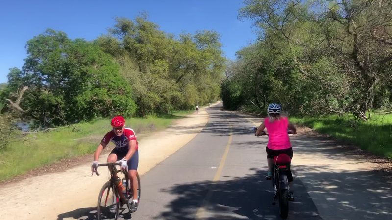
Popularity has a price. Some days on the trail get pretty busy, with lots of cycling traffic.
Most riders pass each other well and follow good etiquette. That shared courtesy keeps the whole path running smoothly.
Road cyclists love the long, paved miles. Runners often use the soft decomposed granite shoulder right alongside.
That dirt shoulder is easier on knees and keeps runners out of fast bike traffic. Everyone wins.
Families on trikes and casual walkers belong here too. The wide trail gives room for many paces at once.
Calling out before passing helps a lot. A simple heads-up beats a surprised jump from someone ahead.
Inline skaters also roll along these miles. Leave them space, since quick stops aren’t their strong point.
The Sacramento Northern Bikeway connects to the trail, too. That opens even more riding for locals in the area.
Visitors rate the trail a glowing 4.9 stars on Google. Plenty of riders call it their favorite place to ride, and that friendly vibe surely plays a part.
Sunrise To Sunset, All Year Long, So Pick Your Miles
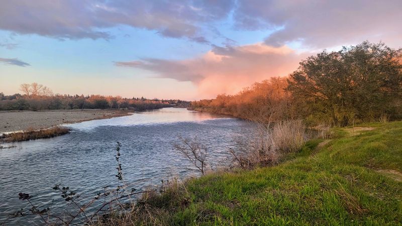
Here’s an easy schedule to remember. The trail is open year-round from sunrise to sunset.
That means you can plan a spring ride, a fall cruise, or a cool winter outing. Each season paints the river a little differently.
Bring the basics before you go. Water, a helmet, a snack, and a charged phone make any ride smoother.
Choose your entry point based on your goal. Discovery Park works for city starts, while Beal’s Point suits lake lovers.
Shorter outings can start at parks in between. That’s a great option for families or newer riders.
Is the Jedediah Smith Memorial Trail still worth the hype in California? With 32 car-free miles and decades of national recognition, I believe it is.
Few places let you cross bridges, pass parks, and reach a historic town on one path. That variety is hard to beat.
Sunsets here also have fans. Finishing your ride as the sky turns gold sounds like a fine plan.
So pump up those tires. The Jedediah Smith Memorial Trail is ready whenever your legs are.