Fifty-two miles of smooth asphalt, and not a single car allowed on any of it. That alone got my attention.
The path follows one of the earliest inland routes in North America. Native Americans blazed it long before English colonists showed up and started using it too.
Today it links two of the most important cities in Virginia’s story. Along the way, it passes old James River plantations, battlefield ground, wooden bridges, and farm fields.
I like how the history just sits there beside you instead of behind glass.
You can walk it, bike it, run it, or bring the dog. I can’t imagine a better excuse to slow down and see what the highway rushes past.
So where should you start, and how far will you actually go?
A Car-Free Ribbon Between Two Capitals
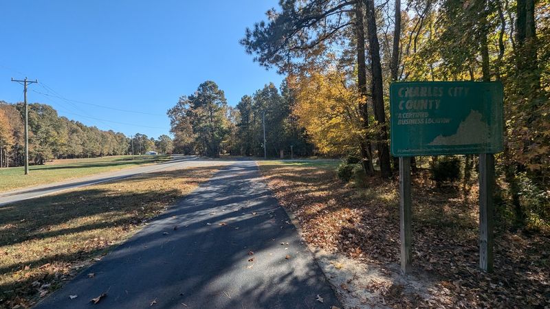
The Virginia Capital Trail connects Jamestown and Richmond with one long, paved, car-free path. Locals often shorten the name to the Cap Trail, which is handy when you’re out of breath.
The route stretches about 52 miles across Virginia. It passes through four jurisdictions: the City of Richmond, Henrico County, Charles City County, and James City County.
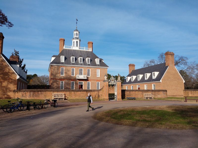
Jamestown was the first capital of the Virginia colony. Williamsburg came next, and Richmond holds the title today.
Some sources count Williamsburg as a linked capital too, since it sits close to the eastern end.
That’s a lot of state history packed into one afternoon ride. You literally pedal from where the colony began toward where the government sits now.
The trail runs largely beside Virginia Route 5. That road carries a Virginia Scenic Byway designation, so the neighbors are pretty easy on the eyes.
Mile markers count up from zero at Jamestown. That makes it simple to track your progress and plan a turnaround point.
No address leads to one door here, because the trail itself is the destination. Officially, it simply lives in Virginia, USA, spread across a wide stretch of the James River region.
Footsteps Older Than the Colony Itself
Long before bikes and asphalt, people traveled this corridor on foot. Native Americans first blazed the route, making it one of the earliest inland paths in North America.
English colonists later adopted the same line through the land. It made sense, since it tied the river settlements together.
Fast forward a few centuries, and construction on the modern trail began in 2006. Crews finished the full route in 2015, nearly a decade later.
That’s patience on a grand scale. Then again, the original path took a few thousand years to become famous, so nine years feels speedy.
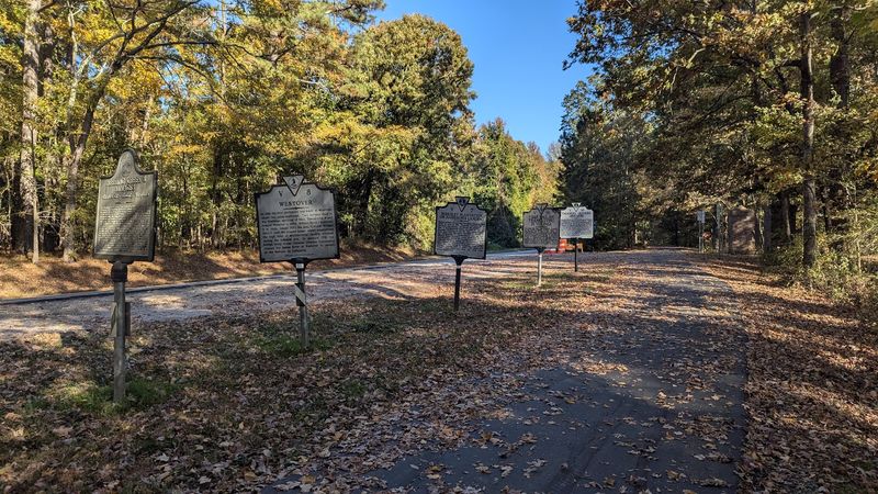
What I love is how little you need to imagine. The road beside you still follows that ancient line, and historical markers pop up frequently along the way.
Riders who’ve covered big chunks of the route mention lots of these markers. They make natural rest stops, too, if your legs need an excuse.
The trail carries a National Recreation Trail listing as well. That federal nod puts it among notable trails around the country.
So every mile has backstory. You’re not just exercising, you’re tracing one of the oldest travel routes in the country.
Plantation Country the Highway Speeds Past
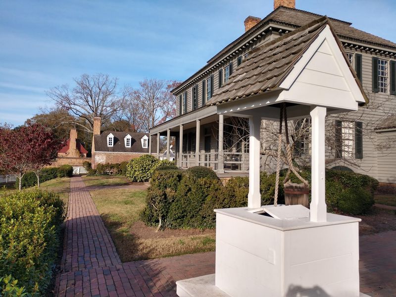
Drivers on Route 5 get glimpses of grand old estates in a blur. Trail users get time to actually look.
The Virginia Capital Trail provides access to several historic James River plantations. Many sit in Charles City County, the quiet middle stretch of the route.
The Google Maps description sums it up nicely. It mentions former presidents’ homes and colonial plantations along the way.
That’s not a typical trail perk. Most bike paths offer a nice tree or two, maybe a duck if you’re lucky.
These properties hold layered and complicated history. Their stories include colonial wealth and the enslaved people whose labor built and sustained them.
Visiting with that full picture in mind makes the experience richer. It turns a pretty ride into a real lesson about Virginia’s past.
Keep in mind that the plantations themselves are separate sites. Some operate as museums or private estates with their own schedules and rules.
Check each site before planning a stop. That way you won’t roll up to a closed gate with high hopes and a hungry stomach.
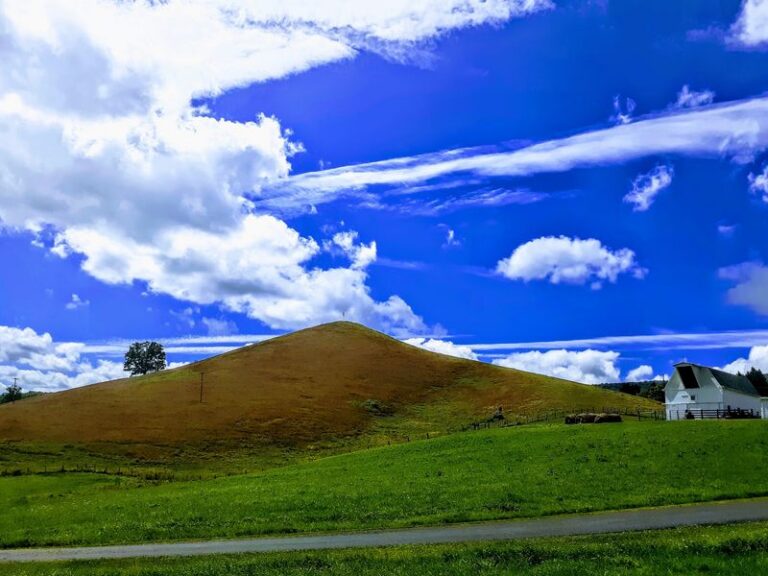
Even from the trail, the scenery shifts into open farmland and long stretches of country calm.
Battlefields Hiding in Plain Sight
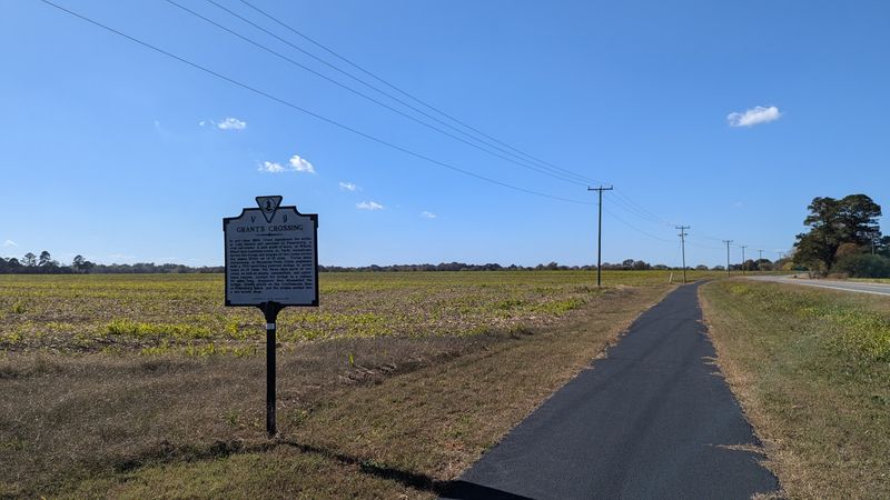
Two major chapters of American history left their mark along this corridor. Revolutionary and Civil War sites both sit within reach of the trail.
That’s a remarkable combination for one route. Few paths let you cover centuries of conflict-era history with a water bottle and a helmet.
Today these places are calm and open. Fields and woods have replaced the drama, and the trail lets you take them in slowly.
Historical markers help you connect the dots as you go. They’re a smart way to learn without hauling a textbook in your bike bag.
History buffs can easily build a whole day around these stops. Pick a section, set a pace, and read every marker you pass.
Families might enjoy this approach too. Kids tend to remember a story better when they’re standing near where it happened.
The Henrico County stretch closer to Richmond adds to the mix. It sits near some of the most studied ground in Virginia.
I believe that’s the trail’s quiet superpower. It turns abstract dates into real places you can stand beside, breathe in, and actually remember later.
Smooth Asphalt That Spoils You Fast
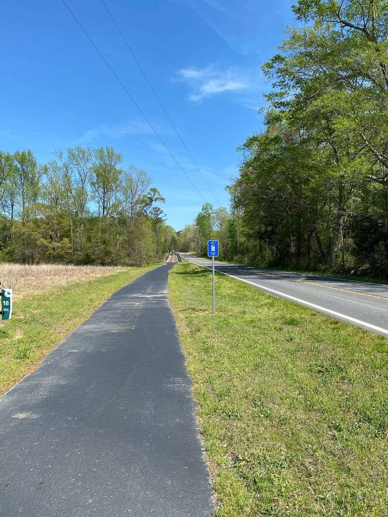
Anyone raised on bumpy gravel rail trails will feel a little pampered here. The surface is asphalt the whole way.
Width typically runs from eight to ten feet. That leaves room for passing, side-by-side chats, and the occasional wobbly beginner.
Riders often describe the surface as smooth across long distances. One cyclist reported a smooth ride for 35 straight miles.
Of course, nature eventually gets a vote. Some sections show ripples from tree roots, and a few stretches have been freshly repaved.
Tree roots are persistent little troublemakers. Keep your eyes forward in the shaded parts, especially on skinny road tires.
Elevation stays friendly for most people. Riders describe the first 20 miles from Jamestown as very flat.
Between roughly mile 20 and 35, mild hills appear. Nothing brutal, just enough to remind your legs they’re working.
The bridge near the southern end brings one of the more noticeable climbs. It’s short, though, and the views make the effort worthwhile.
Mountain bikes, road bikes, and hybrids all handle it fine. Bring whatever you’ve got and enjoy the glide.
Wooden Bridges and an Osprey Show
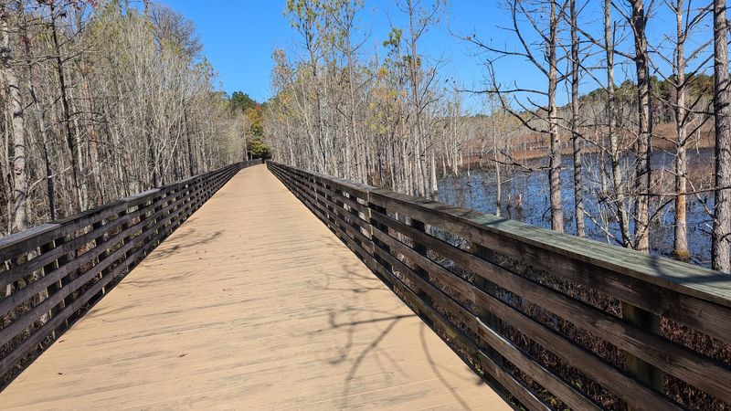
Here’s a fun surprise: the trail crosses water on long bridges, not just pavement. Wooden bridges show up in the trail’s own description.
The bridge over the Chickahominy area near the southern end stands out. It lifts you above marsh and open water for a wide view.
Wildlife likes these spots too. One rider spotted an osprey nest with chicks on a bridge, and watched a parent bring in a fish.
That’s the kind of moment you can’t schedule. Still, keeping your eyes up near water raises your odds.
Birding comes up often in praise for the trail. It works well for walking, biking, and watching feathered locals do their thing.
The mix of woods, fields, and water creates plenty of habitat. You never quite know what will flap past.
Bring binoculars if you’re a bird person. They’re light, and you’ll be glad you packed them.
Pause on the bridges rather than stopping mid-lane elsewhere. Step to the side, let others pass, and soak in the scenery.
Honestly, a few quiet minutes over the water might become your favorite part of the whole ride.
Room for Walkers, Riders, Runners, and Dogs
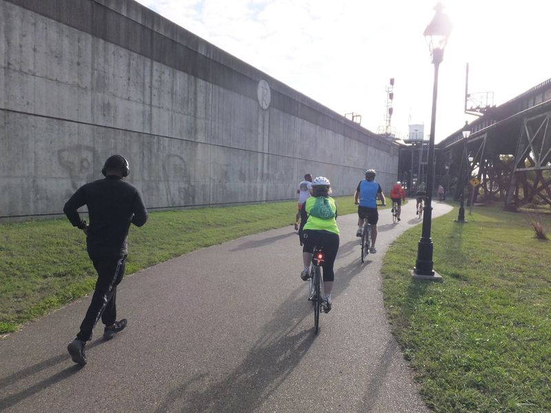
Bikes get most of the attention, but they don’t own the place. The trail welcomes walking, running, biking, and even skateboarding.
Dogs are welcome too. Keep a leash handy and pack bags, since you’ll share space with lots of people.
All abilities fit here. The flat stretches suit beginners, while long distances tempt serious cyclists chasing big mileage.
Shared space does require manners. Some walkers have voiced frustration with cyclists who zip by without warning.
A quick bell or friendly “on your left” solves most of that. Slow down near families, kids, and pets.
Walkers can help by staying to the right. Nobody needs a surprise game of human pinball.
Many people praise the trail as safe. With no vehicle traffic on the path itself, it feels relaxed compared with road riding.
Road crossings do happen, though. Riders describe them as not too busy, but stay alert at each one.
Shade and open areas alternate along the route. Sunscreen and a hat earn their spot in your bag on bright days.
Pick your activity and pace. The Virginia Capital Trail treats a slow stroll and a fast spin equally well.
Fall Colors and Perfect-Weather Rides
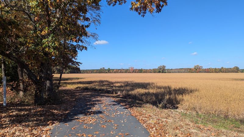
Cool air, warm colors, and smooth pavement make a pretty convincing argument for autumn. Fall comes up again and again in trail chatter.
One rider called fall weather absolutely perfect for a long trip. Another walker praised a beautiful autumn walk in the area.
The tree-lined sections shine this time of year. Shaded stretches turn golden, while open farmland shows off big skies.
Weather matters a lot on a route this long. Summer heat can build fast on exposed stretches without much cover.
Spring brings mild days and greener scenery too. It’s another solid window for longer outings.
Plan around a forecast, not wishful thinking. Rain shelters exist at some stops, but you’ll still want a backup plan.
Mark your calendar for October 24, 2026. The Cap Trail Classic brings extra foot traffic between the Richmond Floodwall and Messer Road in Henrico County.
That’s either a reason to join the fun or a reason to pick another day. Your call.
Either way, a crisp Virginia morning on this trail sounds hard to beat. Good luck staying indoors.
Out-and-Back Epics and Overnight Adventures
Some people ride a few miles. Others treat 52 miles like a warm-up, which feels slightly unfair to the rest of us.
Riders have logged 100-mile out-and-back trips on the trail. One cyclist completed a century ride starting at Four Mile Creek Park in Henrico County.
That ride headed to Richmond and back, then to Jamestown and back. It took a little over six hours.
Overnight trips are popular too. Bike from one end, sleep in Williamsburg, and return the next day.
One rider called it a great overnight trip among options in the greater DC region. That’s high praise for a weekend escape.
Honest note: parts follow the road closely. It isn’t wilderness every mile, and that’s part of its convenience.
Shorter goals work beautifully as well. Pick one section, enjoy it, and save another for next time.
Some riders tackle different segments whenever schedules allow. It’s a fun way to piece the whole route together.
Mile markers make planning easy. Choose a starting number, a turnaround number, and go.
Big or small, every distance counts here. The trail doesn’t judge your mileage.
Restrooms, Shelters, and Where to Refill
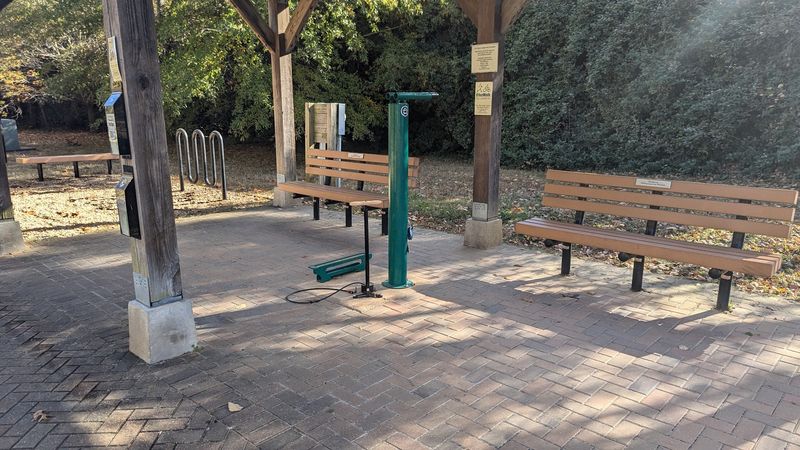
Long trails live or die by their pit stops. Thankfully, this one has a decent network.
The Virginia Capital Trail Foundation manages amenities with the Virginia Department of Transportation. Together they keep stops spread along the route.
You’ll find benches, bike racks, rain shelters, and portable toilets at spots like Herring Creek, Turkey Island, and Great Shiplock Park.
Public restrooms sit at Jamestown Settlement, Chickahominy Riverfront Park, Charles City Courthouse, and Dorey Park. Those make smart planning anchors.
Water access exists at many of these locations. Nearby convenience stores also sell drinks if you run low.
Still, carry more water than you think you’ll need. Hot days and long gaps can sneak up on anyone.
Trash cans are fairly sparse. Plan to pack out what you bring, which keeps the trail clean for everyone.
Some riders wish for more porta-potties in certain stretches. Time your breaks around the known stops.
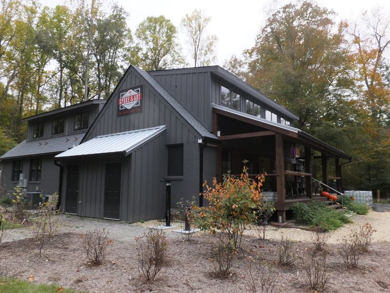
Snacks are worth packing too. One rider made a pleasant snack stop at a trailside shop along the way.
A little planning keeps the ride fun. Nobody enjoys a desperate sprint to the next restroom.
Parking Lots, Trailheads, and Current Closures
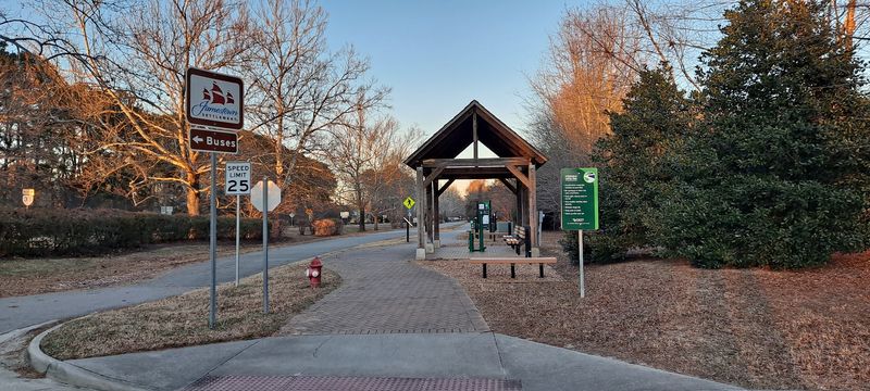
Good news first: the trail is free to use. Even better, many access points offer free parking.
Jamestown Settlement and Great Shiplock Park both have free parking. Jamestown makes an easy start, with ample space near mile marker zero.
Some paid options exist, like Buckland Farms for weekday parking. Check signs before leaving the car.
One quirk to know: the map pin for the trail doesn’t sit at either end. Navigate to a specific trailhead instead.
Now the less fun news. A small Richmond section between Great Shiplock Park at mile 51.2 and the Floodwall at mile 51.7 is closed.
A train derailment in July caused that closure. Full restoration was estimated at three to six months.
Construction is also active at Dock Street Park in Richmond near mile 51.2. Expect detours near the city end.
Check the Virginia Capital Trail Foundation for updates before heading out. Conditions near Richmond may shift.
The trail is generally open for non-motorized use. E-scooters and cars stay off, keeping the pace calm.
Pick your trailhead wisely, and the rest falls into place. Then go enjoy Virginia from the saddle.
Why This Path Earns a Spot on Your List
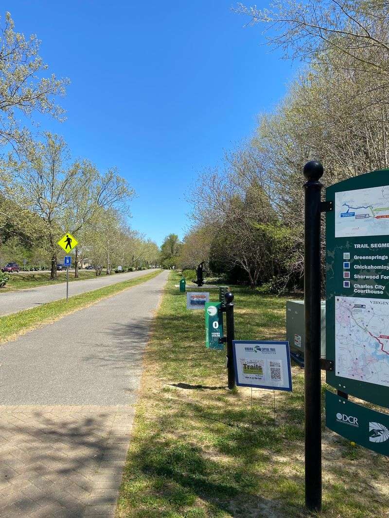
A 4.6-star rating across dozens of opinions says plenty. The praise keeps circling back to scenery, smooth pavement, and safety.
One fan called it one of the best things the region ever did. Another simply called it beautiful and left it there.
That enthusiasm makes sense to me. A free, paved, car-free path through centuries of history is rare anywhere.
It’s not perfect, of course. Root ripples, sparse trash cans, and road-adjacent stretches are real trade-offs.
Still, those quibbles feel small next to what you gain. Plantations, battlefields, bridges, ospreys, and fall color all share one route.
It suits so many people. Casual walkers, birders, families, dog owners, and century riders all fit comfortably.
Start small if you’re new. A flat stretch from Jamestown makes a great first taste.
Then come back for more. Plenty of folks ride different sections whenever life allows.
The Virginia Capital Trail rewards curiosity and steady pedaling. It shows a side of Virginia most drivers zoom right past.
So grab a bike, lace up, or leash the dog. Fifty-two miles of history are waiting, one mile marker at a time.