Steam trains once crawled up these mountain grades so slowly that locals named the line after a vine. That nickname stuck long after the last train rolled through in 1977.
Today the old rail bed carries bikes, hikers, runners, and horses instead. Nearly 50 wooden trestles still cross creeks and valleys along the way.
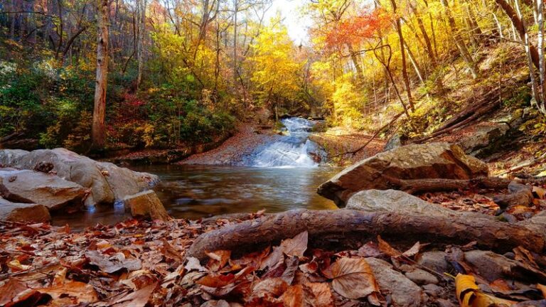
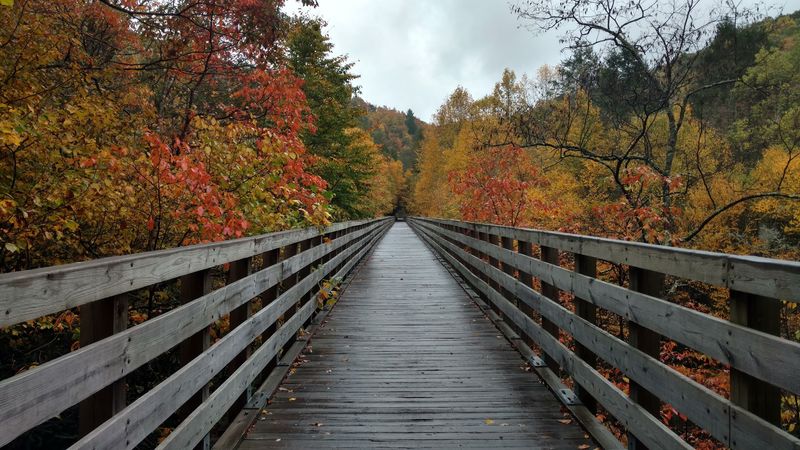
And in October, the whole corridor turns orange, russet, and red.
I like how this path feels built for slowing down. There are no cars, no honking, and no traffic lights.
Just leaves, rushing water, and the hum of tires on gravel in southwestern Virginia.
There is one twist worth knowing before you go. A 2024 hurricane hit the upper half hard, so part of the trail is still being rebuilt.
So which half can you ride this fall, and is it worth the trip?
Thirty-Four Miles Of Mountain Path With Zero Traffic Jams
Southwestern Virginia hides a ribbon of old railroad that cars simply aren’t allowed to touch. The Virginia Creeper National Recreation Trail runs 34 miles from Abingdon to Whitetop Station, close to the North Carolina line.
It’s a multi-use path, which means everyone gets a turn. Bikers, e-bikers, hikers, runners, and horseback riders all share the same gentle grade.
The trail carries serious credentials, too. It’s a designated National Recreation Trail and joined the Rail-Trail Hall of Fame in 2014.
Along the way, it links small mountain communities like Abingdon, Watauga, Alvarado, and Damascus. It also passes through Straight Branch, Taylors Valley, Creek Junction, and Green Cove.
The scenery shifts constantly, which keeps the miles from blurring together. You’ll roll past farmland, dense woods, river valleys, Christmas tree farms, and splashing creeks.
Mount Rogers National Recreation Area sits nearby, framing the upper stretch with high country. That location gives the trail its cool mountain feel at the top end.
Best of all, there’s no need to share the road with anything louder than a bike bell. That alone makes the Virginia Creeper National Recreation Trail feel like a small vacation from modern life.
A Name Borrowed From A Vine And A Very Slow Train
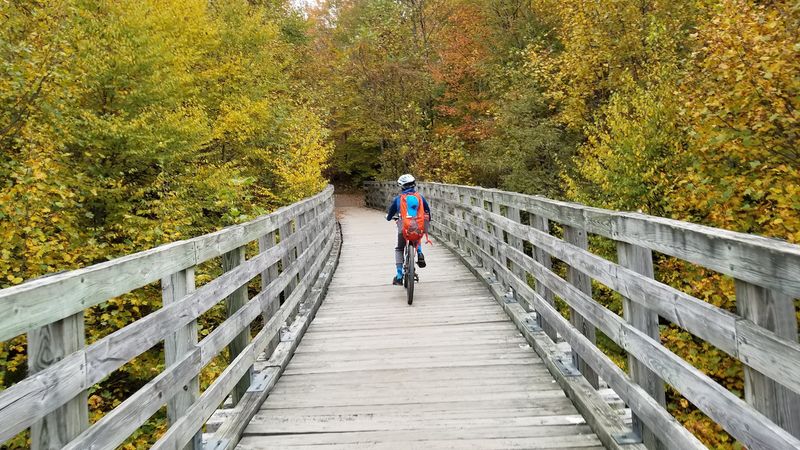
Blame the steam engines for the funny name. Locomotives crept so slowly up the steep mountain grades that locals started calling the line the Virginia Creeper.
The nickname also nods to a native plant. Virginia creeper, a climbing vine, grows across the region and turns bright red in fall.
The railroad story begins in the late 1880s. The Abingdon Coal and Iron Railroad Company laid out the original right-of-way.
The line kept pushing deeper into the mountains over the following decades. It reached Whitetop by 1912 and stretched 75 miles to Elkland, North Carolina, by 1918.
Elkland is now called Todd, in case you go hunting for it on a map. The trains hauled timber, goods, and passengers through some seriously rugged terrain.
Then the rails went quiet. The last train ran on March 31, 1977, ending the line’s working life.
A decade later, the corridor got a second act. The rail-trail opened to the public in 1987, turning a slow train route into a slow-on-purpose adventure.
Honestly, the creeping pace suits the trail even better now. Nobody here is in a rush.
October Turns The Whole Corridor Into A Color Tunnel
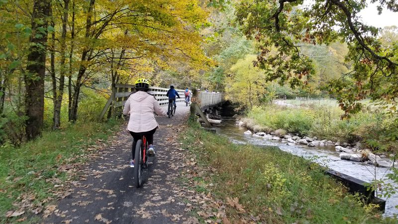
Orange, russet, and red stack up overhead until the trail feels like a tunnel of leaves. Virginia tourism writers have called this the kind of corridor you remember for years.
Peak color usually lands in October. That’s when the hardwoods along the creeks and hillsides put on their full show.
The changing elevation helps stretch the season a bit. Higher ground near Whitetop sits above 3,500 feet, while lower sections near Abingdon sit far below.
Because the scenery shifts between farms, forests, and river valleys, the color never looks the same twice. One mile might frame a red maple against pasture, and the next a gold canopy over water.
Moving at bike or walking speed makes a big difference here. You actually get time to notice individual trees instead of a smear through a car window.
The creeks add their own sparkle when leaves drift onto the current. It’s the kind of view that makes people stop mid-ride just to stare.
Bring a jacket, since mountain mornings in autumn can run chilly. Then plan to stop often, because the camera will keep coming out.
Nearly 50 Wooden Trestles Give You Treetop Views
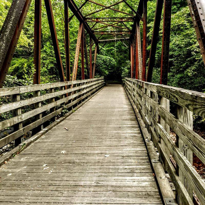
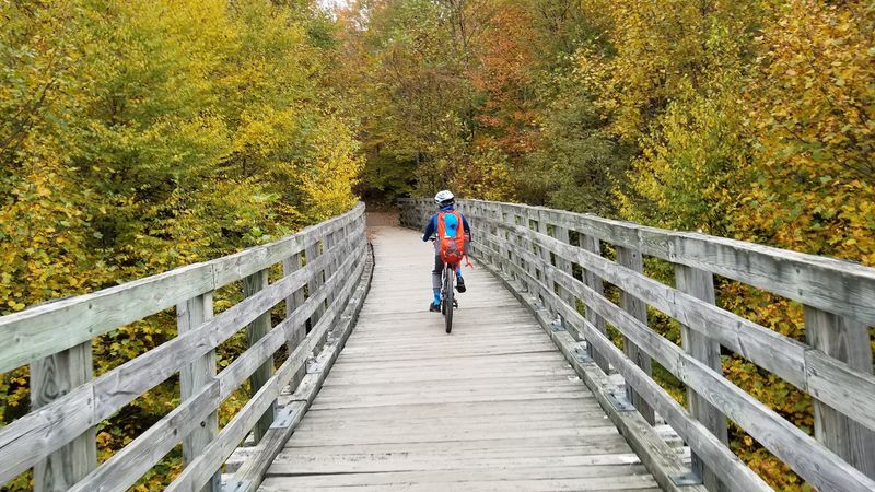
Wooden trestles are the trail’s signature move. Nearly 50 of them carry the path across creeks, ravines, and valleys along the route.
Each crossing gives you a sudden lift above the landscape. One moment you’re in the woods, and the next you’re floating over rushing water.
In fall, those bridges become front-row seats for the color. Leaves spread out below and beside you instead of only overhead.
The trestles also connect you to the railroad past in a very real way. They follow the same paths the old trains used to cross these mountains.
Sadly, the bridges took the hardest hit in recent years. Hurricane Helene damaged 30 of the 31 historic trestles on the upper half in September 2024.
Repair work is underway, and that’s good news for future trips. Rebuilding that many bridges in steep terrain takes time and care.
The lower stretch still offers plenty of trestle crossings to enjoy now. Slow down on each one and look both ways, mostly for the scenery.
What Is Open Right Now, And What Is Still Mending
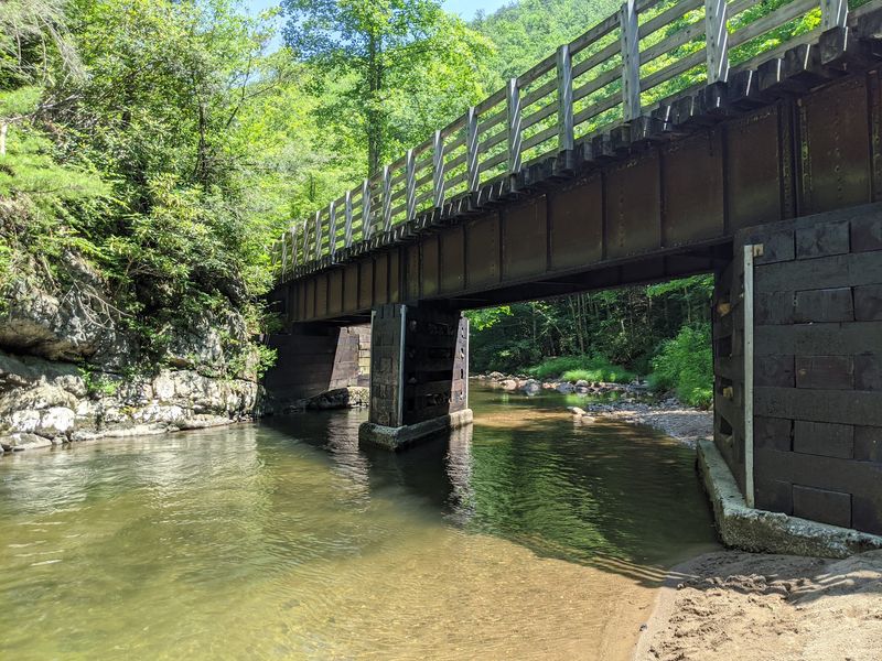
Here’s the honest scoop before you load the car. The trail is partially open while crews repair storm damage from Hurricane Helene.
The roughly 17-mile section from Abingdon to Damascus is fully open. That stretch still delivers creeks, farmland, forest, and plenty of trestles.
The upper half is a different story for now. The roughly 17 miles from Damascus to Whitetop Station are closed for reconstruction.
The September 2024 storm caused extensive damage up there. That included 30 of the 31 historic trestles on that portion of the route.
The full 34-mile trail is projected to reopen on March 31, 2027. That date happens to match the anniversary of the last train run in 1977, which is a nice touch.
Projected dates can shift with weather and construction, so stay flexible. Always check current trail conditions before you plan a ride.
The good news? An open 17 miles of Virginia mountain trail is still a full day of fun.
Many families find that distance just right anyway.
The Famous Downhill Glide Worth Waiting For
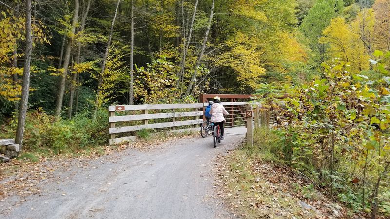
Gravity does most of the work on the trail’s most beloved ride. The 17 miles from Whitetop Station down to Damascus are mostly downhill.
Whitetop Station sits at 3,576 feet, the highest point on the whole trail. From there, the route drops about 1,600 feet in a gentle, steady descent.
That grade is why the ride became such a favorite. You coast past Christmas tree farms, Green Cove, and Creek Junction without much pedaling.
The overall trail is often described as bowl-shaped. Damascus sits in the low middle, with climbs rising toward each end.
For now, this stretch is part of the closed upper half. Reconstruction is underway, with full reopening projected for March 31, 2027.
When it returns, it should feel like a reward for patience. Rebuilt trestles and familiar views will be waiting.
Until then, keep it on your someday list. A downhill mountain ride through fall color is worth a little waiting, right?
Swimming Holes, Trout Water, And A Famous Footpath Crossing
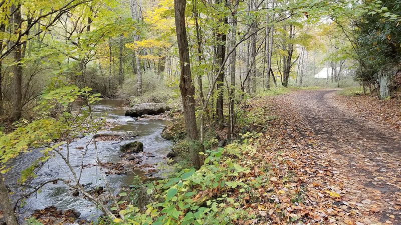
Water follows you for much of the journey. Laurel Creek and the South Fork Holston River run close to the trail in many places.
Those streams offer access to fishing and swimming holes. In warmer months, a cool dip makes a great midride break.
By fall, the creeks become more about looking than leaping. Still, the sound of rushing water adds a soothing soundtrack to every mile.
Anglers can bring gear and try their luck along the banks. Just check Virginia fishing regulations and licensing rules before casting.
Here’s a fun bonus for hikers. The trail intersects with the Appalachian Trail at several points.
That means you might share a short stretch with long-distance backpackers. Damascus has deep ties to that famous footpath too.
It’s a neat reminder that this region is a crossroads of trails. Bring a snack, find a rock by the water, and enjoy the view.
Damascus Is The Trail Town At The Center Of It All
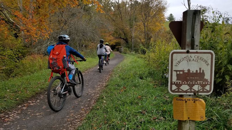
Smack in the middle sits the town that feels like the trail’s living room. Damascus marks the halfway point and the low spot in that bowl-shaped profile.
Damascus Town Park serves as a key trailhead. You’ll find it at 202 South Beaverdam Avenue, Damascus, VA 24236, with public restrooms on site.
Many outfitters in town offer bike rentals and shuttle services. That makes it easy to show up without your own gear.
Safety got an upgrade here too. A newer tunnel lets cyclists pass under the busy intersection of Highway 58 and Highway 91.
That means no nervous waiting for a gap in traffic. The car-free promise holds up even in town.
From Damascus, the open section heads west toward Abingdon. It’s a natural place to start, finish, or grab lunch in between.
Small-town Virginia charm comes standard. Park, rent, ride, and let the afternoon unfold.
Abingdon Makes A Handy Starting Line
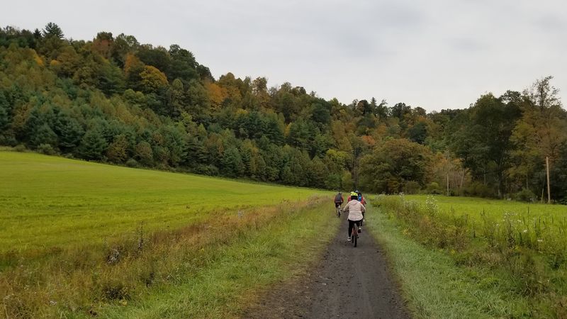
Out on the western end, Abingdon kicks things off. The trailhead sits at 303 Green Spring Road, Abingdon, VA 24210.
Restrooms are available at this trailhead, which always helps before a long ride. Outfitters in Abingdon also rent bikes and run shuttles.
Starting here lets you ride the open 17 miles toward Damascus. Along the way, you pass Watauga and Alvarado.
Watauga Crossing and Alvarado Station both have public restrooms. That spacing makes the ride friendlier for kids and casual riders.
The scenery opens up with rolling farmland and river valleys on this stretch. Then the woods close in as you approach the river.
Remember that bowl shape when planning. Riding from Abingdon to Damascus trends downhill overall, which many riders appreciate.
A shuttle back saves your legs for exploring later. Or turn around and earn your dinner the old-fashioned way.
An Old Depot With Plenty Of Stories
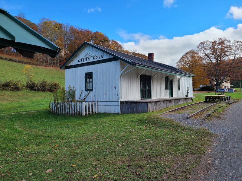
Some stops along a trail feel like time capsules. Green Cove Station is one of them.
The building once served as a train station, country store, and post office. Today it works as a visitor center along the upper trail.
Picture the role it played when trains still crept through these hills. It connected a remote mountain community to mail, supplies, and the wider world.
Public restrooms are available here as well. Creek Junction and Whitetop Station on the upper stretch also have them.
These spots sit on the section currently closed for reconstruction. They’ll be part of the experience again when the full trail reopens.
Food stops also appear about every eight miles from Whitetop to Damascus. That rhythm made the downhill ride feel easy to plan.
When the upper half returns, Green Cove deserves a pause. A little history makes the ride downhill even sweeter.
Room For Wheels, Hooves, And Sneakers
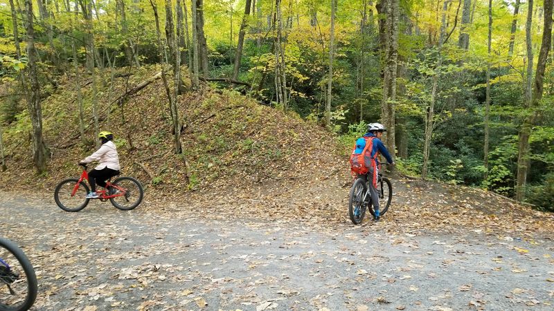
Few trails welcome this many kinds of travelers. Bikes, e-bikes, hikers, runners, and horseback riders all belong here.
The old railroad grade keeps things gentle. Trains needed easy slopes, and that works out nicely for families and newer riders.
Kids can roll along without dodging traffic. Parents can relax without worrying about cars sneaking up behind them.
Runners get a soft, scenic route with plenty to look at. Hikers can pick a short out-and-back and turn around whenever they like.
Horseback riders share the path too, so good manners matter. Slow down, give space, and say hello when passing.
E-bikes make the climbs friendlier for folks who want a little help. They also stretch how far you can comfortably explore.
Basically, there’s a version of this trail for nearly everyone. Just pick your pace and enjoy the quiet.
Why This Trail Belongs On Your Fall List
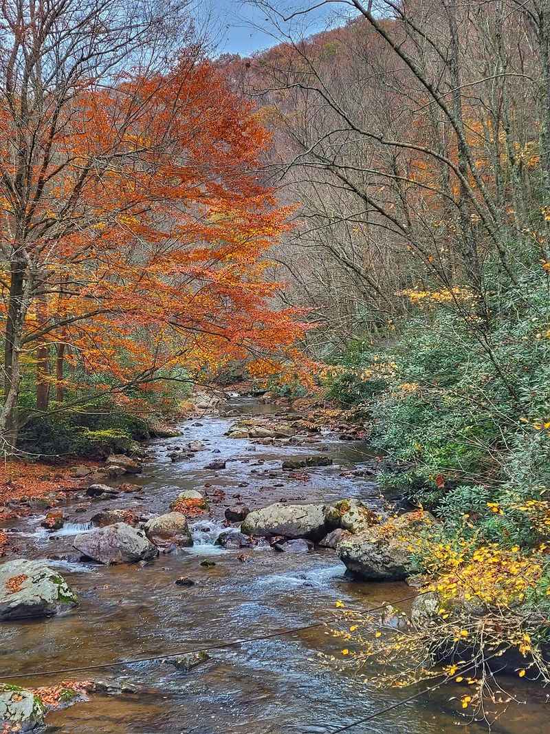
Quiet is the real luxury out here. No engines, no horns, just leaves, water, and wheels on gravel.
The Virginia Creeper National Recreation Trail pairs that calm with real history. A slow train route became one of the most loved rail-trails in the country.
Right now, the open 17 miles between Abingdon and Damascus deliver plenty. Fall color, trestles, creeks, and easy trail towns all wait there.
The upper half will return with rebuilt bridges, likely in 2027. That gives you a great excuse for a second visit.
I can’t imagine a calmer way to soak in an Appalachian autumn. October peak color makes the timing almost too easy.
Check trail conditions, book a rental or shuttle if needed, and pack layers. Then let southwestern Virginia handle the scenery.
The creeping trains are long gone. Lucky for us, the creeping pace stuck around.