A jagged wall of rock called the Sierra Buttes rises more than 8,000 feet into the sky. A fire lookout sits right on top, reached by steel staircases bolted to the cliff.
Below those peaks, a tiny mountain town sits in a river canyon at about 4,147 feet. The North Yuba River runs right alongside it.
Gold Rush history still hangs around in old mine buildings and weathered storefronts.
Most drivers on Highway 49 in California keep their eyes on the curves and roll on through. I can’t imagine doing that once I knew what was waiting.
I like how this place feels unhurried and real, like a page from an older California.
So what exactly are all those cars missing? Quite a lot, it turns out, and fall is a lovely time to find out.
A Canyon Town You Could Miss In A Single Blink
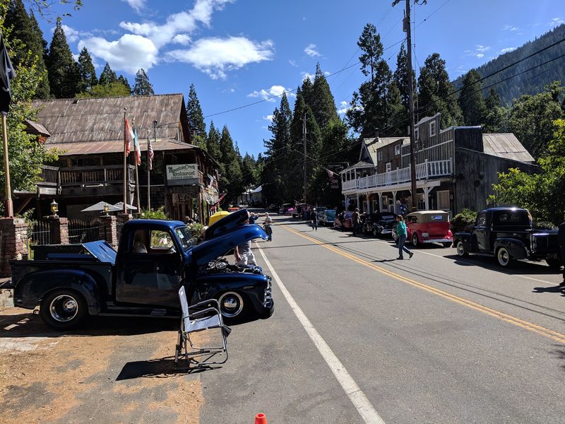
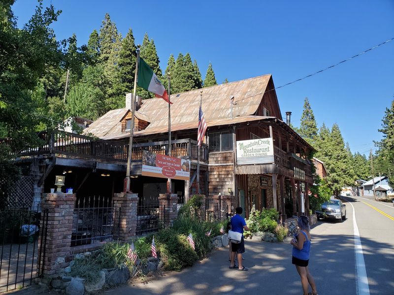
Blink on the drive and you might miss it entirely. Sierra City, California, stretches along State Route 49 in the canyon of the North Yuba River.
The town sits at about 4,147 feet in Sierra County. That puts it high enough for crisp air, but low enough for easy summer strolling.
Downieville, the county seat, lies roughly twelve miles to the southwest. The two towns share the same winding highway and the same river.
Sierra City is a census-designated place, not an incorporated city. That’s a fancy way of saying it stays small, and seems happy about it.
Highway 49 carries plenty of road-trippers through this canyon. Many treat the town as a quick slowdown before the next bend.
That’s a shame, because the scenery here is the main event. The Sierra Buttes loom directly above town like a stone crown.
Pine forest climbs every slope around you. The river keeps up a steady soundtrack below the road.
I believe the best small towns feel like they were here first. Sierra City definitely gives off that energy, and it earns a proper stop.
Gold Fever Built These Streets Long Before Road Trips Existed
Gold came first, and the town followed. Sierra City grew out of the California Gold Rush in the 1850s.
Miners poured into the northern Sierra chasing quartz veins and river gold. The rugged slopes under the Buttes turned out to hold real treasure.
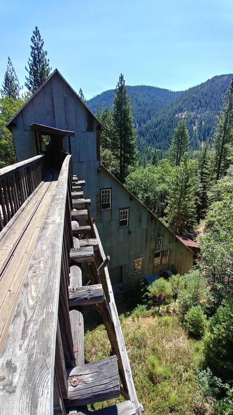
Hard-rock mines tunneled into the mountainsides around town. Stamp mills crushed ore to free the precious metal inside.
The area became famous for big finds during those boom years. That reputation helped Sierra City stick around while other camps faded.
Plenty of mining towns vanished completely once the gold ran thin. This one kept its people, its buildings, and its stubborn spirit.
Walk the main stretch today and that history still shows. Older structures line the highway and give the town its frontier look.
In fast-changing California, that kind of continuity feels rare. A town that outlasted its own boom is a small act of preservation.
History fans will feel right at home here. It’s the kind of place your grandparents might have stopped on a summer drive, and it still welcomes you the same way.
Those Jagged Peaks Overhead Have A Name Worth Knowing
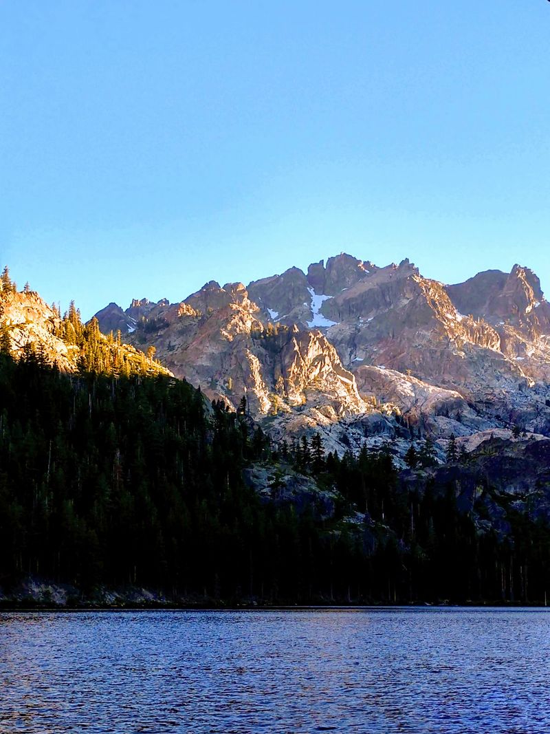
Look up from almost anywhere in town. Those dramatic spires belong to the Sierra Buttes, the signature skyline of this corner of California.
The Buttes rise to more than 8,500 feet at their highest point. That’s over 4,000 feet above the town sitting at their feet.
Their shape is what really grabs you. Instead of a smooth dome, you get rugged, broken pinnacles that look almost carved.
Morning and evening light can paint the rock in warm shades. It’s the sort of view that makes you pull over without planning to.
The peaks also tie straight into the town’s story. Gold mines once worked the slopes beneath these ridges.
Today, the Buttes mostly attract hikers, photographers, and anyone who loves a big view. They’re the backdrop to pretty much every photo you’ll take here.
Honestly, it’s hard to believe so many drivers barely glance up. A mountain range this striking usually comes with a crowd.
Here, you often get it with peace and quiet instead. That trade feels like a pretty great deal to me.
Stairs Bolted To A Cliff Lead To One Wild Lookout
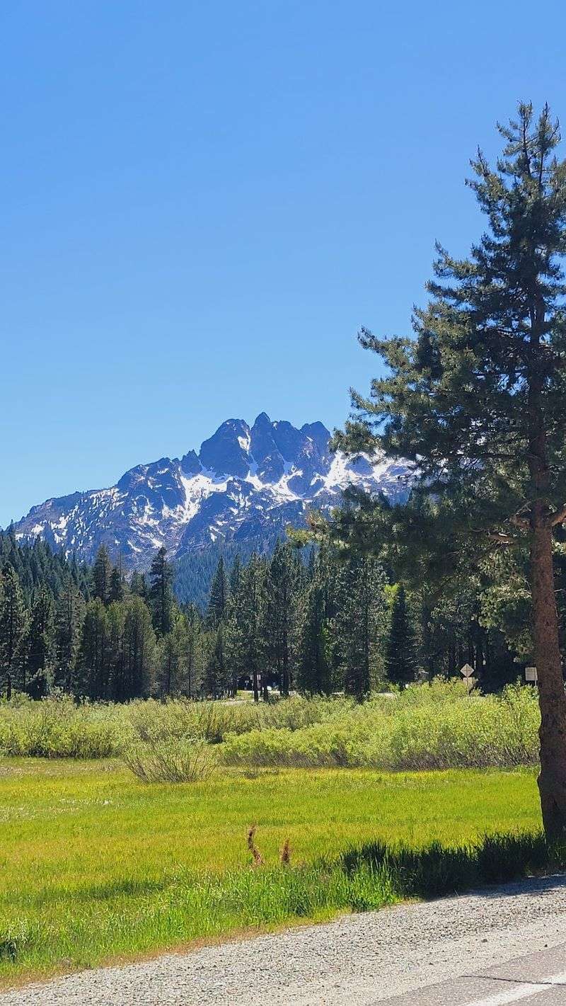
Steel staircases clinging to a cliff edge. That’s how you reach the fire lookout perched atop the Sierra Buttes.
The lookout sits at roughly 8,587 feet above sea level. The final climb uses metal stairs attached to the rock, with serious drop-offs below.
It’s thrilling, and it’s definitely not for everyone. Anyone uneasy with heights may happily stop before the last flight.
The payoff for those who go is enormous. Clear days can bring views across the Lakes Basin and far beyond into the northern Sierra.
Hikers usually reach the summit by trail from trailheads north of town. Routes vary in length, so research your starting point before heading out.
The high trails depend heavily on season and snow. Late spring and early fall can bring changing conditions up top.
By November, winter may already be creeping onto the summit. Check current conditions with the Tahoe National Forest before any attempt.
Pack water, layers, and patience for the climb. Then enjoy one of the most memorable perches anywhere in California.
An Old Stamp Mill Still Tells The Mining Story Best
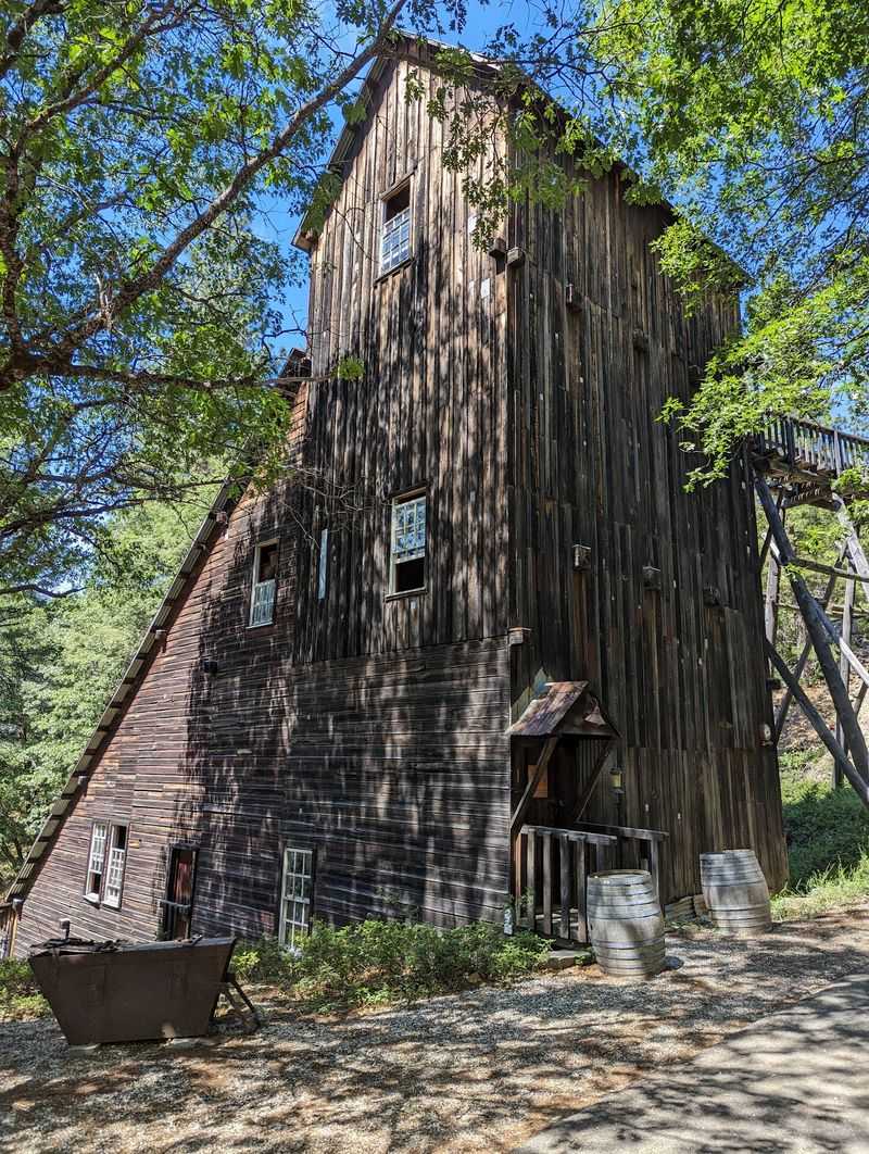
Want to see how gold actually got out of the rock? Kentucky Mine Historic Park and Museum, just outside town, shows you.
The site preserves a historic hard-rock gold mine and its stamp mill. It’s operated by the Sierra County Historical Society.
A stamp mill used heavy iron stamps to pound ore into powder. Gold could then be separated from the crushed rock.
Seeing the mill in person makes the Gold Rush feel less like a textbook chapter. You get a real sense of the noise and muscle involved.
The museum adds artifacts and exhibits about local mining and daily life. It’s a great fit for families with curious kids.
The park is also known for its outdoor amphitheater and summer concert series. Music under the pines is a pretty charming way to spend an evening.
Like much of the region, the museum runs on a seasonal schedule. Expect it to be open mainly in the warmer months.
Check with the historical society before you go, especially in fall. A little planning keeps you from arriving to a locked gate.
The North Yuba River Runs Right Through The Daydream
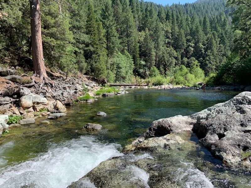
Clear water tumbling over granite boulders. The North Yuba River follows Highway 49 right past Sierra City.
The river carved the canyon that holds the whole town. It shapes the scenery, the sounds, and the mood of the place.
Pullouts along the highway can offer quick river views. Some spots make easy places to stretch your legs and listen.
Anglers often come to this stretch of the Yuba hoping for trout. Always check current California fishing regulations before casting a line.
In summer, the river can tempt you toward cool pools and sunny rocks. Water levels and currents change, so caution matters near the edge.
Fall brings a quieter feel to the canyon. Changing leaves along the river may add pops of color between the evergreens.
The drive itself is part of the experience here. Highway 49 curves gently with the water for mile after mile.
I like how the river keeps everything feeling calm. You came for mountain peaks, and you get a soothing waterway thrown in for free.
Alpine Lakes Sit Just A Short Drive Uphill
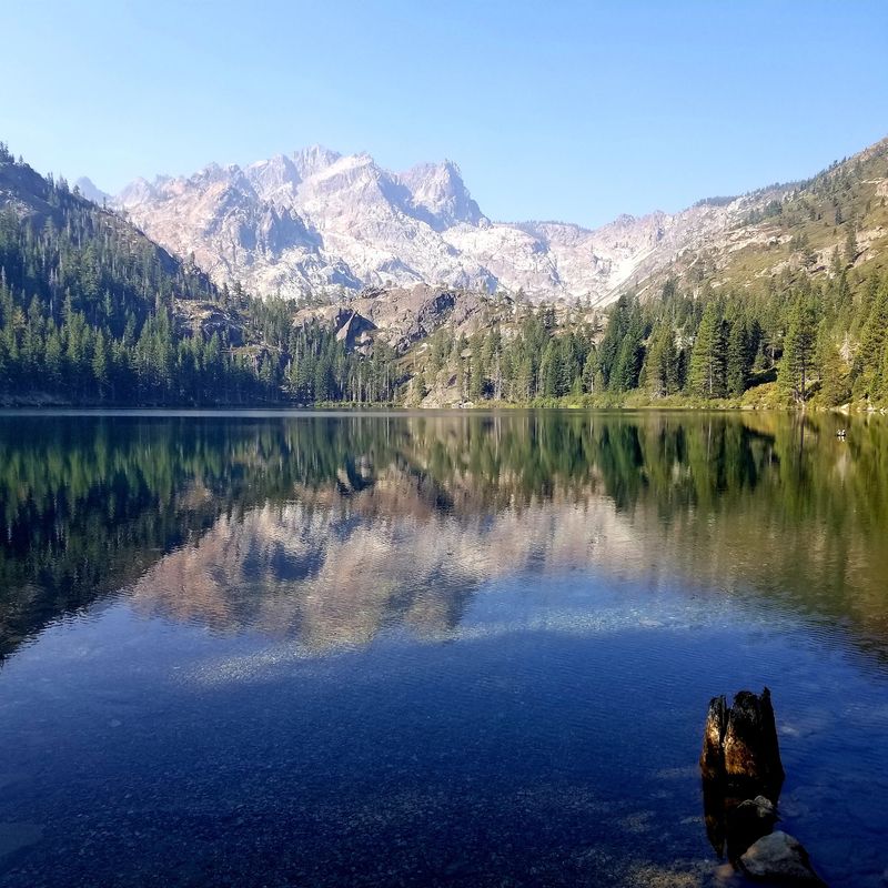
A few miles of climbing changes everything. North of town, the Lakes Basin area holds a cluster of sparkling alpine lakes.
The Sardine Lakes sit right beneath the Sierra Buttes. Their reflection shots of the jagged peaks are the stuff of postcards.
The Gold Lake Highway leads up into this lake country. Trailheads and campgrounds scatter across the basin in summer.
Hikers can link short walks between several lakes. It’s a fantastic area for families who want big scenery without brutal mileage.
Fishing, paddling, and picnicking are all popular warm-season activities. The air feels noticeably cooler up here on hot days.
Timing matters a lot in this high country. Snow typically closes much of the area to regular driving during winter.
Late fall can be a gamble with weather and road status. Check conditions with Plumas or Tahoe National Forest before heading up.
Catch it during the open season, though, and you’re in for a treat. Pair it with a Sierra City stop for one of the best day trips in California.
Long-Distance Hikers Know This Town By Heart
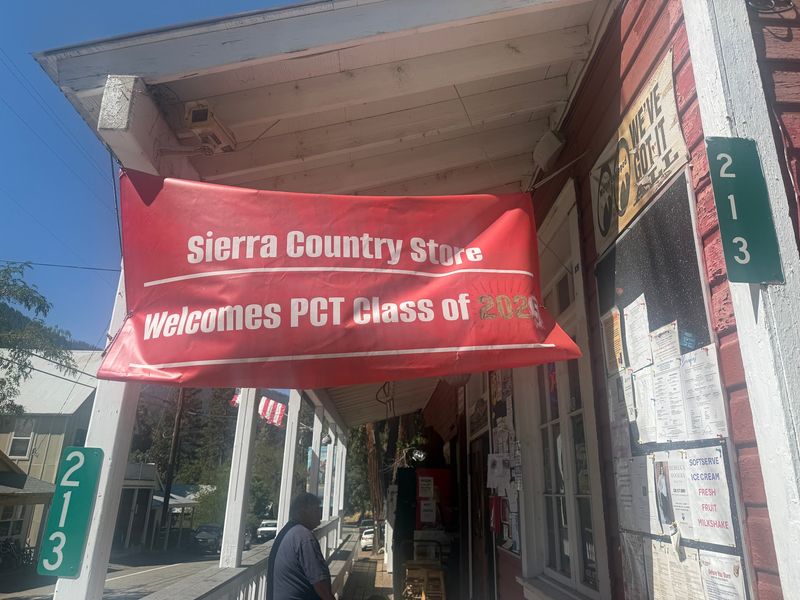
Here’s a fun insider fact. The Pacific Crest Trail passes close to Sierra City on its long route from Mexico to Canada.
That makes the town a well-known stop for thru-hikers. Many walk into town to rest, resupply, and enjoy a real meal.
Picture the contrast for a moment, though not literally. Months of trail life suddenly meet a friendly little mountain main street.
Day hikers can sample the PCT here too. Short out-and-back walks give you a taste of the famous trail.
The trail climbs into dramatic country around the Sierra Buttes. Views open up quickly once you gain some elevation.
Thru-hiker season usually peaks in summer in this section. By fall, the trail grows quieter as hikers push north.
Bring proper footwear, water, and a map for any trail outing. Mountain weather can shift fast, even on sunny mornings.
For hiking fans, knowing about this PCT town feels like joining a club. You’ll start noticing trail stickers and dusty boots everywhere you go.
Slow Afternoons Suit The Folks Who Love This Place Most
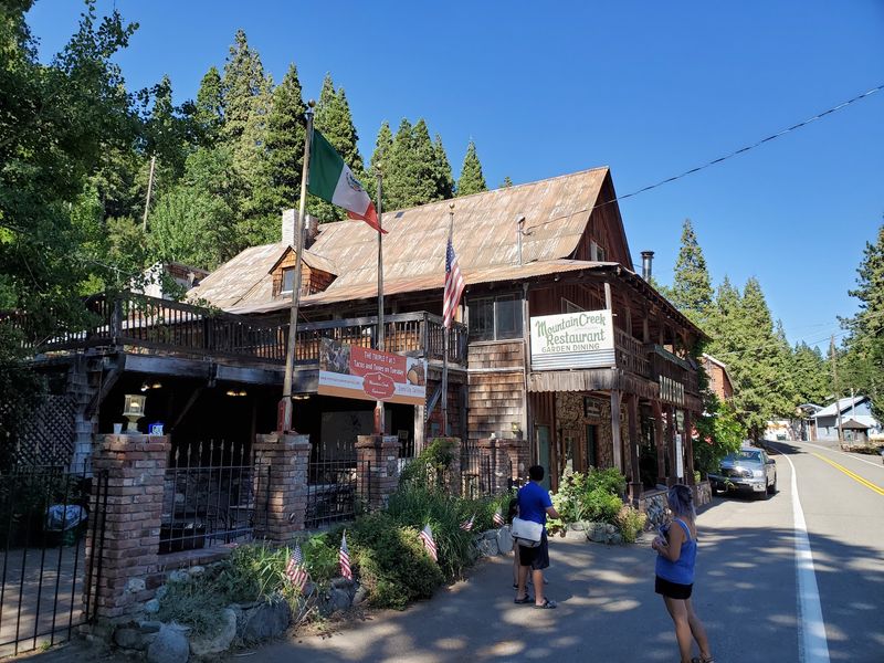
Nobody rushes in Sierra City, and that’s sort of the point. The town moves at a gentle, mountain-time pace.
You won’t find big shopping centers or flashy attractions. Instead, expect small businesses, historic buildings, and a whole lot of nature.
History buffs will love the mining heritage and old structures. Photographers get dramatic peaks, river scenes, and weathered wood textures.
Hikers and anglers may feel they’ve found their personal headquarters. Everything outdoorsy sits close at hand.
Families can mix museum time with easy lake walks nearby. Kids tend to love stamp mills, rivers, and anything involving rocks.
Travelers craving nightlife or crowds should probably look elsewhere. This is a place for unplugging and noticing small things.
Many local businesses operate seasonally, so some may close in colder months. Call ahead before counting on a specific shop or meal.
I believe the quiet here is a feature, not a flaw. In a state packed with busy destinations, a calm canyon town feels like a gift.
Getting Here Means Following One Gorgeous Highway
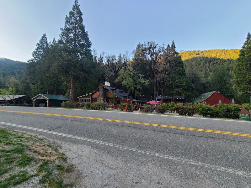
Plug Sierra City, California 96125 into your map. Then get ready for one of the prettiest drives in the northern Sierra.
State Route 49 runs directly through town. Coming from Downieville, you’ll travel about twelve miles up the river canyon.
From the east, Highway 49 connects toward Sierraville and Highway 89. Either direction offers serious mountain scenery.
The road is winding, so give yourself extra time. Slower driving also means more chances to enjoy the views.
Fall can bring cool nights and the first touches of winter weather. Snow is possible at this elevation as the season turns.
Carry chains during colder months and check Caltrans road conditions before leaving. Mountain weather rewards prepared drivers.
Many attractions, like the Kentucky Mine museum, follow seasonal schedules. Summer through early fall usually offers the most open options.
High country roads such as the Gold Lake Highway may close in winter. Plan around that, and your trip will run much more smoothly.
Next Time, Let The Brakes Win Over The Gas Pedal
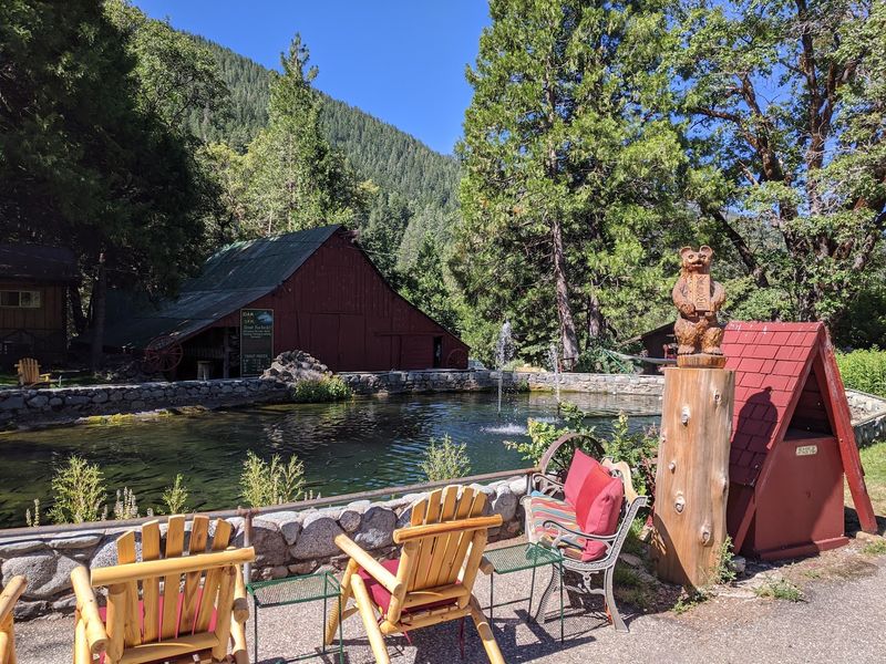
So, is Sierra City worth slowing down for? I’d say absolutely, especially if you love history, hiking, or simply staring at mountains.
The town packs a lot into a very small footprint. Gold Rush roots, a river canyon, and towering peaks all share the same view.
The Sierra Buttes alone justify the detour. Add that cliffside lookout, and you’ve got a story to tell for years.
Kentucky Mine brings the mining past to life in a hands-on way. The nearby lakes add even more reasons to linger.
Timing your visit makes a big difference. Summer and early fall offer the widest access to museums, trails, and high country roads.
Winter can still be beautiful, but plan for snow and limited services. Always check conditions before setting out.
Sierra City rewards travelers who are curious instead of hurried. It feels like a true California secret hiding in plain sight on Highway 49.
Next time your route curves through this canyon, ease off the gas. Those jaw-dropping peaks have been waiting patiently for you.